Content
Day 04: Mukran Port - Sassnitz
Day 04: Mukran Port - Sagard (variant)
Day 05: Sagard - Bergen (variant)
Day 06: Bergen - Swantow (variant)
Day 07: Swantow - Frankenthal (variant)
Day 08: Frankenthal - Altefähr (variant)
Day 09: Day of Rest Altefähr - Stralsund
Day 10: Stralsund - Krummenhagen
Day 11: Krummenhagen - Richtenberg
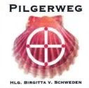
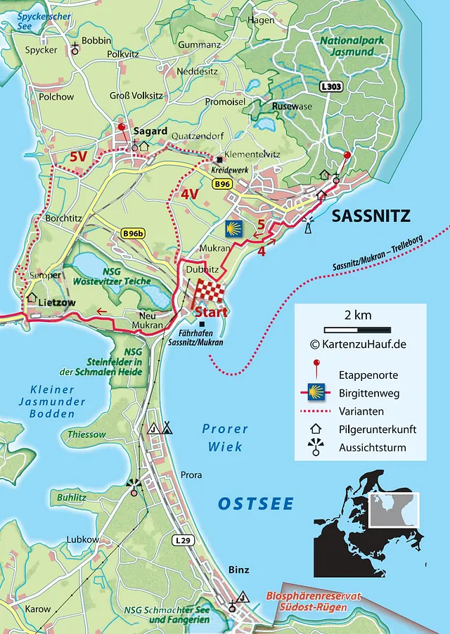
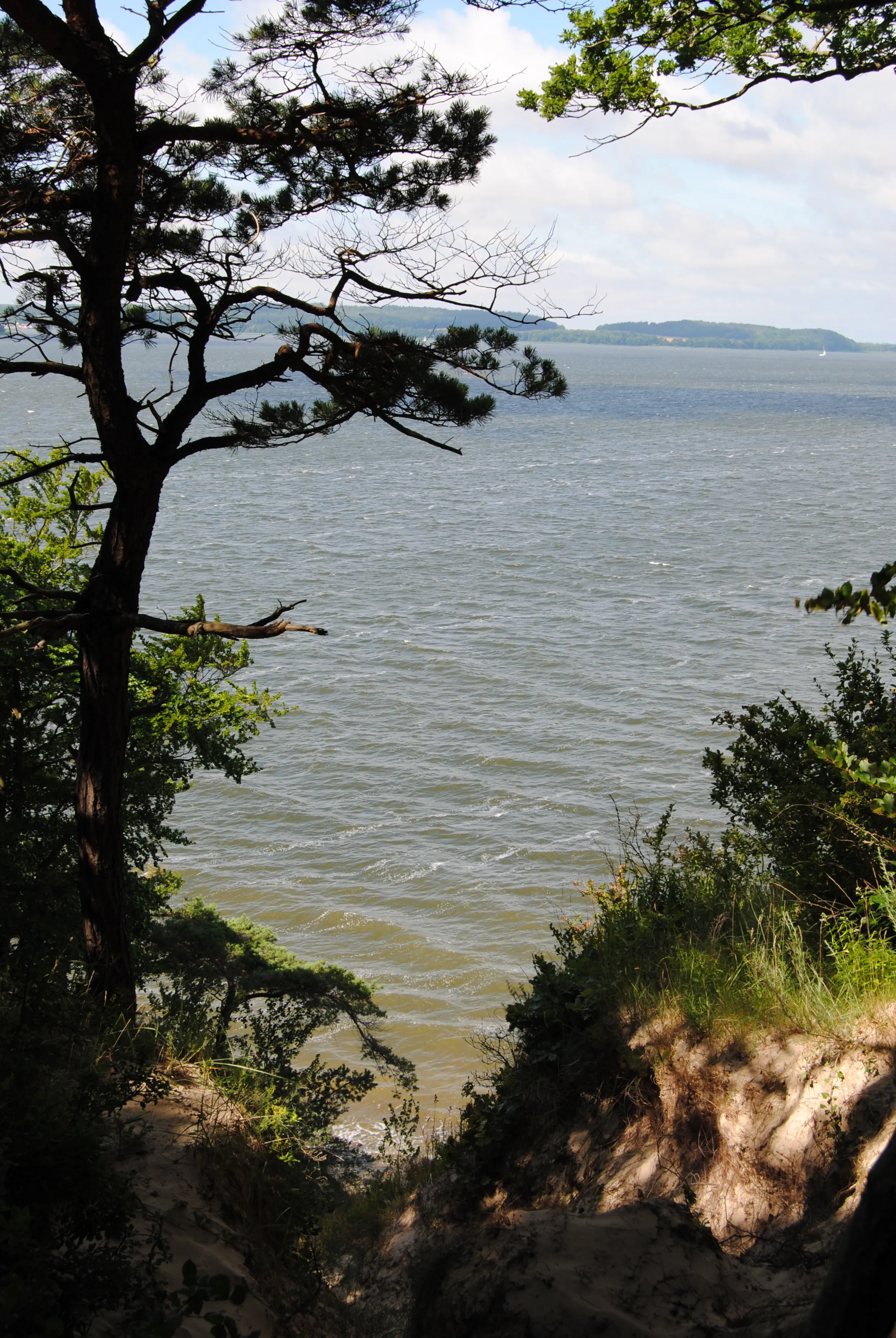
Hike from the ferry terminal to Sassnitz: The rugged high shore is not always in sight, and a gravel plant also blocks the direct route. But if you find the right path, it is a beautiful stage through nature and along the water.
Starting point: Mukran Ferry Terminal
Destination: Sassnitz
Distance and time: 10 km, 3 hours
Address and contact details for accommodation
Sassnitz: Altes EWerk hostel for pilgrims, Stubbenkammerstraße 67, 18546 Sassnitz, phone: +49 (0) 38392 67749, mobile: +49 (0) 173 3880521 (Diana Wagner), double room for up to 8 people, shower, no kitchen, breakfast, half board possible, accommodation from €20 per person, discount for pilgrims.
Sassnitz: Grundtvighaus multigenerational house, Seestraße 3, 18546 Sassnitz, phone: 0049 38392 577726, www.grundtvighaus-sassnitz.de, simply furnished hostel, shared shower, self-catering kitchen, overnight stay from €20 per person
Please note:
Pastor Nieber blesses pilgrims by appointment, parish office at Walterstraße 2, 18546 Sassnitz, phone: +49 (0) 38392 23892, sassnitz@pek.de.
The pilgrims' hostel E-Werk provides a pilgrims' stamp and possibly a church key.
Directions:
The pilgrimage route across the island of Rügen begins at the Mukran ferry terminal. The ferry terminal area is completely fenced off, so you have to leave the area first and then walk back towards Sassnitz. From the ferry terminal, cross the parking lot and then leave the area towards the main road, like the cars. Turn right at the main road and follow the bike path past the houses of the village of Dubnitz. Cross the road and walk onto the paved path. On the hill, at the fork, the path leads downhill towards the water. Shortly before the steep coast, walk along the fence of the Schmid organic farm. The owner explicitly allows it on a sign in front of his house. At the end of the fence, you have to take a few careful steps between two fields to reach the Sassnitz Golf Club. With respect for the golf course, cross the terrain at the edge first to the left, then straight ahead, parallel to the coast, until you reach the golf course entrance. Turn right here and follow the access road for a short distance. At the end of the road, a footpath begins on the left. At the next fork, turn left (the road straight ahead leads to a bathing area and then ends in the bushes). The path swings to the left again. On the left-hand side is the “Fürstengrab” (princely tomb), a rectangle from pre-Christian times surrounded by stately megaliths. Passing this megalithic tomb of Dwasieden, the route soon enters the forest. Over two hills, the path leads past a memorial to the victims of the Second World War. A bench invites you to linger.
The path leads slightly downhill, straight ahead and then along behind the Empor Sassnitz e.V. sports field. Here it comes to the turning area of the “Straße der Jugend”. The pilgrimage route follows this road, past the Sassnitz vocational school, turning right and then right again, down to the harbor. Passing the Rügen fish processing plant, the route continues along the harbor, with the water remaining on the right. At the old ferry terminal, where the Peters bakery now operates a branch (something to eat and drink is available here at any time of the day), the pilgrimage route swings up the bridge. The footbridge was built in 2007. With its barrier-free and elegant sweep to the sea, it won the 2010 Bridge Construction Award.
At the top of “Rügenplatz”, the path continues to the right. Passing the high-rise of the Rügenhotel, it enters “Seestraße”. On the right-hand side, you will soon see the Grundtvighaus, where you can stay overnight. At the back of the house, at “Walterstraße 2”, is the parsonage. Continue to the church: “Seestraße” runs parallel to Sassnitz's main street until “Hafenstraße” and is a lot quieter. Every side street to the left leads to the “main street”, from where the brick church can be seen. It stands on a hill. The pilgrims' hostel EWerk, with a tall brick chimney, is located on the left of the church at the edge of town, where the Stubbenkammer forest begins.
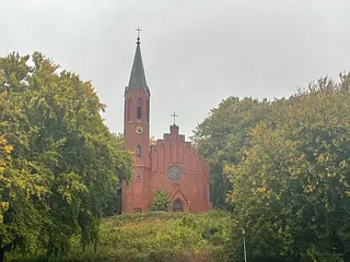
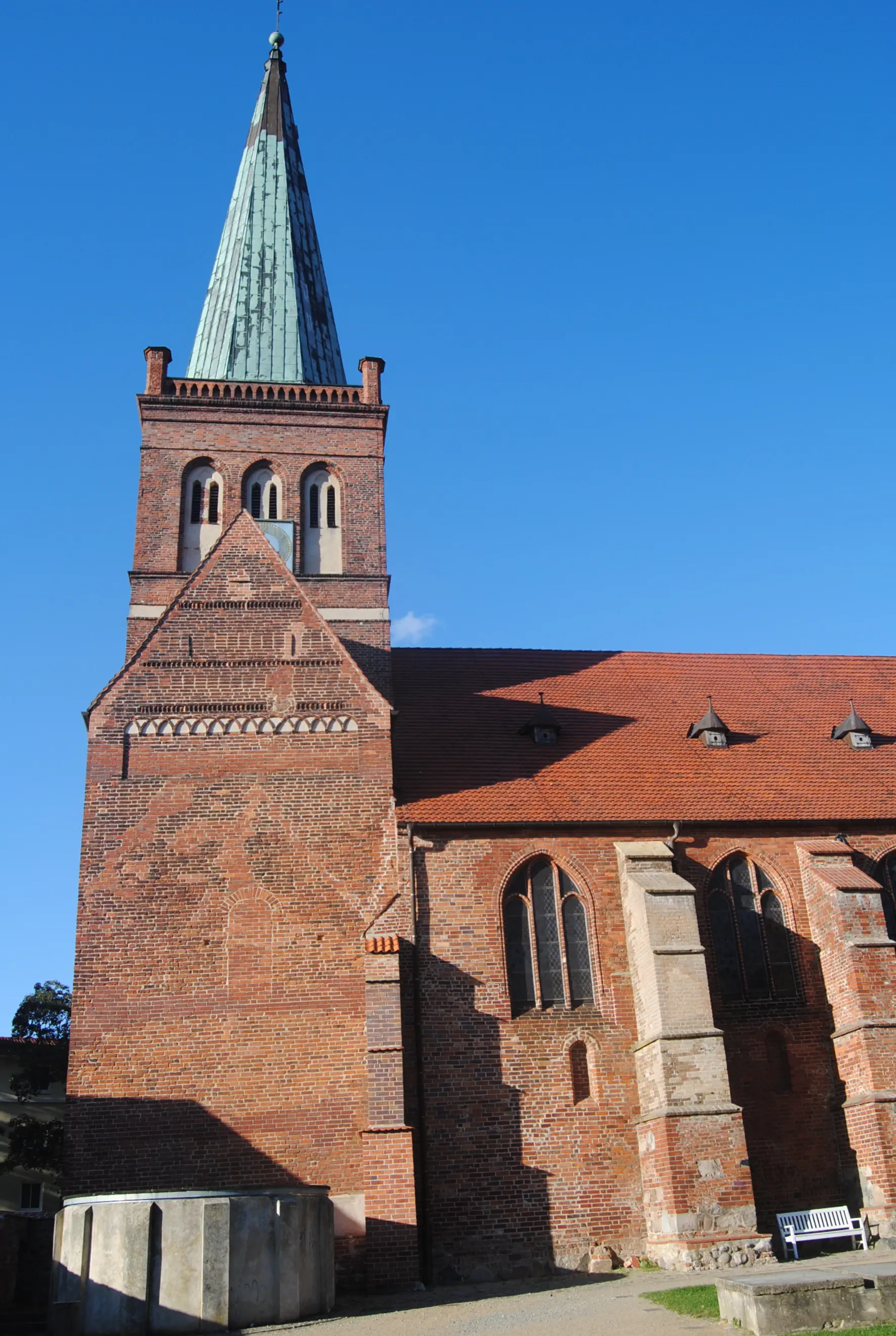
St. Johannis Church (Sassnitz):
Brick church from the 19th century, just before the Jasmund National Park. The interior is invitingly bright with colorful windows. On the wall facing the altar are paintings: “Jesus saves the sinking Peter” on the left and “The Risen One” on the right. The key to the church is available from the rectory or possibly from the EWerk pilgrims' hostel.
Morning Prayer
Lord, the day begins. The sun rises. It is wonderfully beautiful to behold. The glistening on the water. The play of light in the trees. Before me lies the path. I do not know what I will encounter today, who I will encounter on my way. Who will come towards me, who will overtake me, who will walk with me. – But I hope that you will accompany me, talk to me, be silent with me and weep with me. – Amen.
Midday Meditation
Paths are made by walking. – At first there is wilderness. Then the first footprints – searching. A beaten track forms. Other people come towards me on the way and can provide information about where the road leads. Sometimes I realize on the way that this may not be the appropriate direction, the right way. – Then I turn around and keep looking for the right way for me. – Giving up would be wrong. – Paths arise when we go them!
Evening Prayer
I have arrived, God. I take off: my backpack, my walking stick, my shoes. I let go: my worries, my tensions, my questions. I let myself fall: into sleep, into rest, into your hands. Amen.
Address and contact details for accommodation
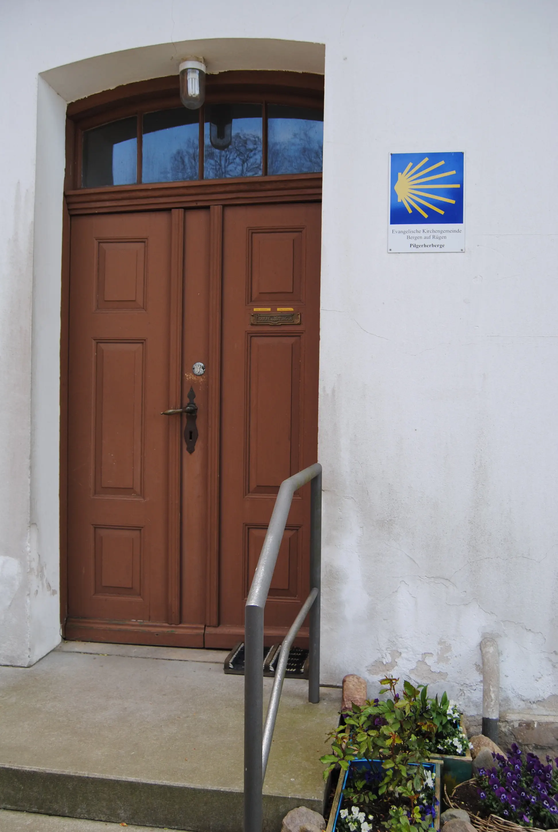
Bergen: Pilgrim hostel, Billrothstr. 22, 18528 Bergen, Tel. 03838 253873 (Pilgrim Mother) or Tel. 03838 253524 (parish office), www.pilgerherberge.kirche-bergen.de, ten beds in three bedrooms, shower, kitchen. You can also get a pilgrim's stamp here. Price: €20, pilgrims: €10.
Lietzow: (If the daily distance seems too much for you, you can split it into two stages.) Lietzow guest house and Störtebeker camp, Waldstrasse 59 a, 18528 Lietzow/Rügen, tel. 0049 38302 2166, www.lietzow.net, accommodation from €15.50 per person in a double room
Please note:
Those who came from the ferry port the day before can probably dispense with the description to Mukran, because the route is initially identical in the opposite direction.
Directions:
The pilgrimage route across the island of Rügen begins at the hill by the Church of St. John in Sassnitz. Going down the stairs, you will come to a crossroads. Follow the “main street” through Sassnitz for about 700 meters until the Rügenplatz on the left offers a view of the Baltic Sea. The pilgrimage route leads over the pedestrian bridge down to the harbor, then continues with the Baltic Sea remaining on the left. Passing the Rügen fish processing plant, the route turns right uphill into “Straße der Jugend”. At the second street, the pilgrimage route turns right, then left, leaving the vocational school behind. Before the sports field, it turns left into the forest. After a short distance, at the fork, turn slightly right towards the war graves memorial. The memorial to the victims of the Second World War lies quietly in the middle of the forest. A bench invites you to linger.
Straight ahead, the path descends through the forest. After a right-hand turn, the path narrows and the forest thins out. Further on, the path leads past a striking megalithic grave and across rough grassland meadows until it meets a passable spur road. Follow this road to the right, away from the coast. After about 300 meters, turn left onto a dirt road with the sign “Golfplatz”. At the end of the Sassnitz Golf Club grounds, turn left and walk as far as possible to the coast. You will reach the fence of a sheep meadow. The owner, Biohof Schmid, explicitly allows walkers to walk along the fence towards the Mukran ferry port. The fence extends to a passable access road, where you should follow the paved path to the right. At the fork on the hill, turn left and follow the path downhill to the country road (L29). Cross the road and turn left onto the pedestrian and cycle path through the village of Dubnitz to the traffic lights. Now turn left again towards the ferry terminal. This time, cross the traffic lights and then continue in the direction of travel on the narrow pavement over the bridge.
At this point, there is no way to avoid walking along the main road. The road passes the striking glass building of the Peters bakery (Café Bäckerei Peters, Fährhafen Mukran, Zum Fährblick 4, 18546 Sassnitz, phone 0049 38392 31011, www.baeckerei-peters.de, open Mon–Sun 7 am–6 pm) and through the district of Neu Mukran. Shortly after the town exit sign, the route crosses the main road again into a path. If you miss the path, cross the road when you see the large sign “Parkplatz Feuersteinfelder” (Feuersteinfelder parking lot) on the opposite side.
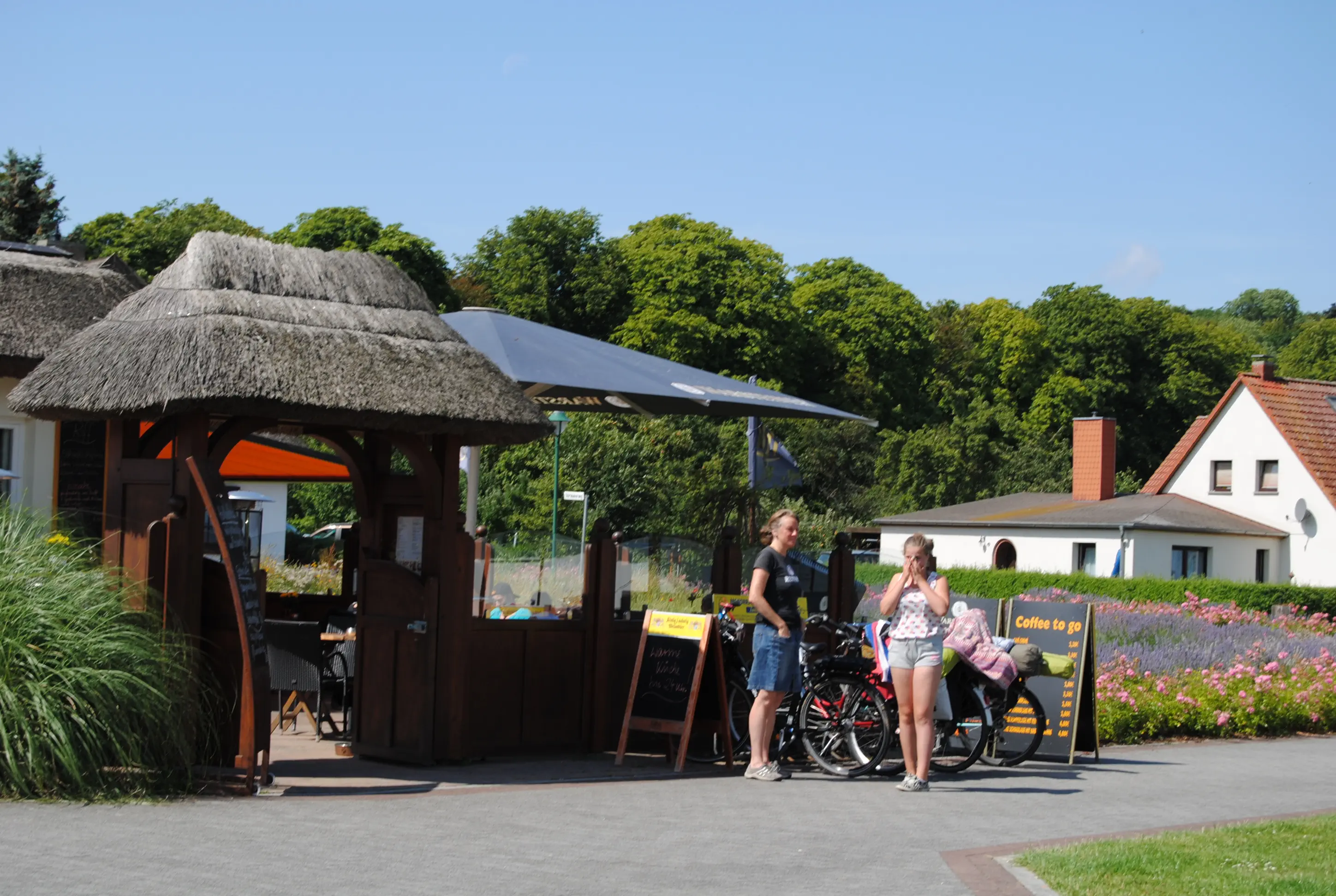
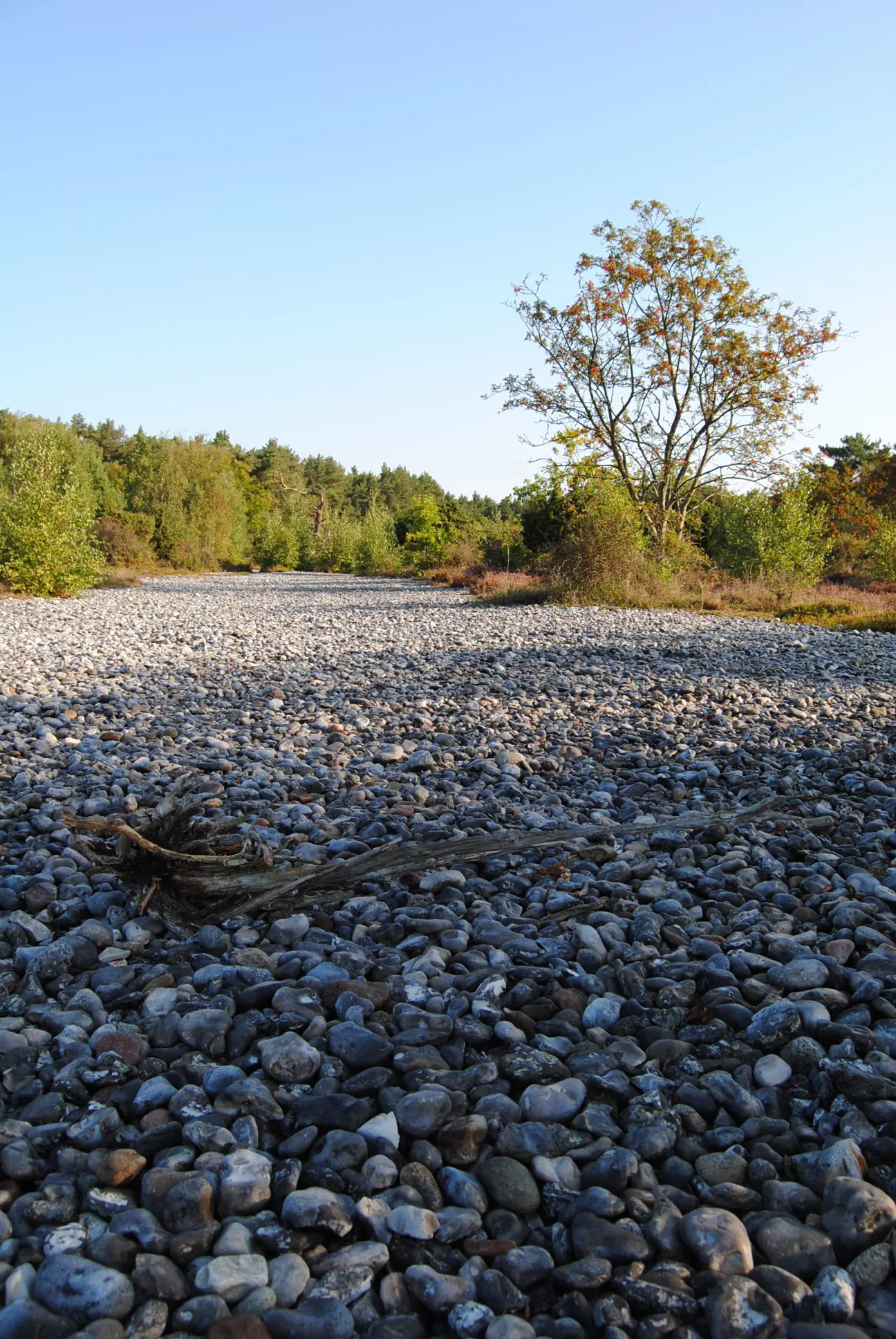
Pass the fruit stand in the parking lot (open from May to September) and follow the green signs for “Feuersteinfelder” behind it. After a few hundred meters, the path to the fields branches off to the left over a bridge over the railroad tracks; the pilgrimage route continues straight ahead on the Boddenpanoramaweg, which is marked in light blue-gray. A detour to the “Steinmeer” (sea of stones), about a kilometer away, is worthwhile. Probably around 4,000 years ago, large storm surges pushed tons of flint together into two-kilometer-long walls. Shortly after the turnoff over the bridge, a sign for “Lietzow (north variant)” points the pilgrims to the right. The forest path is well signposted, but if in doubt, continue straight ahead. At a red and white barrier, it leads (signposted) to the left through a mixed forest. Then it runs through a beech forest, through a clearing down to the Bodden, where it goes right, first over a tributary, then over the railroad tracks. Between the Bodden and the railroad, you walk - with a magnificent view over the water, as far as the church tower of Bergen - into Lietzow. Here the pilgrimage route crosses the railroad tracks, at the main road (B96) it leads to the left over the dam that separates the small from the large Jasmunder Bodden. Behind the dam, the pilgrimage route follows the green hiking signs to Ralswiek, turning right into the beautiful forest. The E10 hiking trail is well marked; if you are unsure, follow the signs to the right towards the Bodden coast. About a kilometer before you reach the town of Ralswiek, a path leads between the reeds and the high bank, where it meets the E10. After the red and white barrier, the path forks again and then comes together again. Where the asphalt begins, you can turn right to reach Ralswiek after 100 meters via a footbridge. There are two thatched-roof picnic tables and the Café Riff (open daily from 2 p.m. from April to October, closed Mondays and Tuesdays). Ralswiek is the venue for the Störtebeker Festival from June to September. There are numerous food stands in the entrance area of the festival grounds, but they only open before the start of the performances. Take the footbridge back to the pilgrimage route, which leads to the main road. Turn left there to reach the red Swedish chapel of Ralswiek.
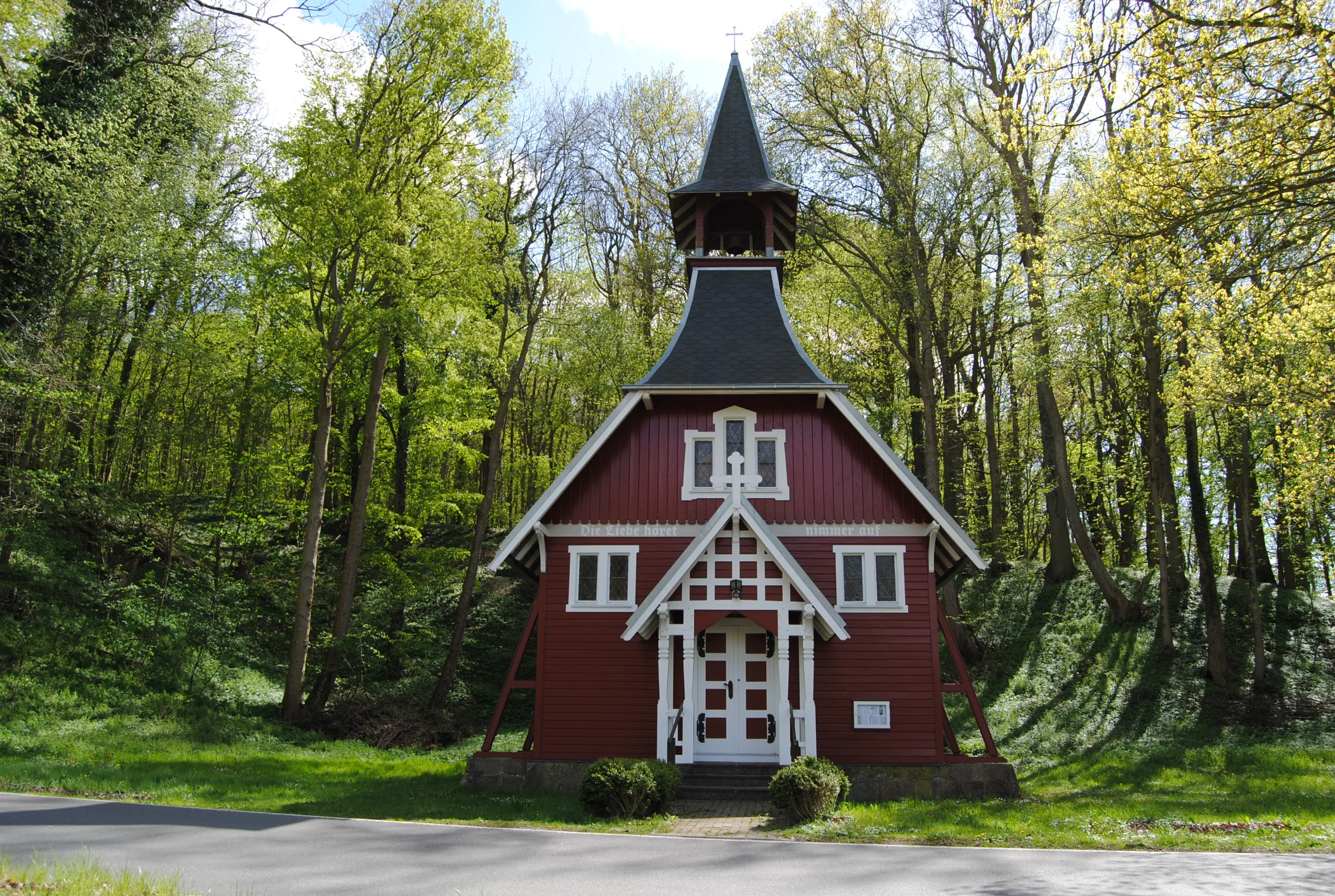
Schwedenkapelle (Ralswiek):
The small, red-and-white wooden chapel is an architectural peculiarity on Rügen. It was exhibited as a model chapel in Stockholm and was intended to be the prototype for prefabricated chapels that can be erected anywhere. Rebuilt in Sweden and in Ralswiek, it was consecrated in 1907. It belongs to the Protestant parish of Schaprode. The few dates on which services are held here are posted next to the door.
Directions:
A few meters before the chapel, turn right onto the little-used road up to Jarnitz. Behind the village, the road turns left, while a beautiful, grassy dirt road leads straight ahead to three houses about a kilometer away. Behind the first house (painted gray), the pilgrimage route continues straight ahead to the main road (B96). The foot and cycle path along the road is on the other side of the road. Along the road, it is only about one kilometer to the second turnoff to the left, towards Prisvitz, past a rustic shelter. Behind the level crossing, the paved path runs to the right between fields and isolated houses. Finally, it comes to a road where, according to the signpost, it goes right to Bergen. The path leads along the edge of the forest, up past a paddock and ends next to the summer toboggan run. The pilgrimage route first leads left along the “Stedarer Weg”. At the end of this, turn right into the “Rugardweg”, which turns into the “Vieschstraße”. This leads directly to Bergen's market square. The town information office is located in a historic half-timbered house opposite. Between the post office and the town information office, a path leads into the monastery courtyard. On the right-hand side is one of the oldest churches on Rügen, the Marienkirche. The pilgrims' hostel is located directly in front of the portal.
St.-Marienkirche (Bergen):
The second oldest church on Rügen should definitely be visited. It was built from 1180 by the converted Slavic king, Prince Jaromar I, and consecrated as a monastery and palatine church in 1193 by the Danish Bishop Absalon of Roskilde. You can take in the beautiful furnishings during a church service or concert. The mostly Romanesque wall paintings are the only example of a complete painting of a church in northern Germany. In the chancel, there are painted depictions of hell on the right and of paradise on the left. The tower clock face, which shows 61 minutes instead of 60, is also curious.
Morning Psalm
Oh Lord, what immense diversity your works display! They are all witnesses to your wisdom; the whole earth is full of your creatures.
There is the sea – so vast and wide, with countless animals in it, great and small.
Ships pass by and also the sea monsters that you created to play with them.
All your creatures await you, that you may give them their food in due season.
They get the food you allot them. You open your hand, and they are abundantly satisfied. (Psalm 104:24-28)
Midday Prayer
I'm hungry! Thank you for my picnic!
I'm thirsty! Thank you for the water!
I'm tired! Thank you for the rest!
Evening Blessing
Just as the sun sets every evening and rises every morning, so it is certain that you are loved. Wanted! Not an accident, not a whim of nature! Just as day is followed by night and night by day, so it is certain that God's blessing is with you, above you, before and behind you. And in you! So may God bless you, the Father, the Son and the Holy Spirit! † Amen.
Address and contact details for accommodation
Sagard: Pilgrim accommodation in the rectory of the St. Michaelis Church Sagard, Apollonienmarkt, 18551 Sagard. Overnight stay with sleeping mat and sleeping bag in the community room, toilet and kitchenette available, no shower. If you wish to stay here or visit the church, you must contact the pastor in Sassnitz in advance, tel. 038392 23892, sassnitz@pek.de. Price: A donation is requested.
Sagard: Hotel am Markt and Hungarian restaurant Puszta, August-Bebel-Str. 14, 18551 Sagard, Tel. 038302 3716,puszta-ruegen.de, Price: from €50
Directions:
The pilgrimage route across the island of Rügen begins at the Mukran ferry terminal. From the ferry terminal, cross the parking lot and then leave the grounds towards the main road, like the cars. First, turn right towards Sassnitz. The footpath is located to the left of the road. After about 100 meters, a path leads to the left into the village of Dubnitz. Then turn right at the pond and right again in front of the manor house, where an unpaved road branches off. Follow this road over quite steep hills and past a reception tower. The ascent is worth it – the view of the sea and later, on the other side, of the Great Jasmund Bodden compensates for the effort. At the crossroads, continue straight ahead, leaving the village of Blieschow (with its self-made village sign) on your left. Cross the main road and continue straight ahead to Klementelvitz. There is a lot of traffic here, due to the chalk plant and the recycling center. There is a footpath to the left of the road. The chalk plant in Klementelvitz is the last of many smaller chalk quarries. Today, the chalk is used in the cosmetics and wellness industry under the label “Rügener Heilkreide”, among others. About 100 meters behind the railroad tracks, opposite the plant gate of the chalk plant, an unmarked footpath goes through the forest to Quatzendorf and Sagard. The path is accompanied by small rivers, one of which is obviously ferrous. In Sagard, this rivulet prompted Pastor Heinrich C. von Willich and his brother Moritz to found a bathing establishment in 1794. The doctors of the time recommended hot, cold and plunge baths to maintain health, and Moritz von Willich was a country doctor. Today, the “Brunnenaue”, just behind the Sagard rectory, is considered the cradle of Rügen tourism. Quatzendorf consists of a few beautiful houses along the way. Turn left at a brick chimney. After about 100 meters, a footpath forks off to the left again from the road. The path leads, parallel to the railroad tracks, to the first house in Sagard, the abandoned train station building. One of the last windmills on Rügen stands, without blades, behind it on a hill. At the end of the station, turn right down Ernst-Thälmann-Straße to Mittelweg. You can already see the steeple of Sagard church up on the right. The parsonage is located behind St. Michael's Church on the left.
St. Michael's Church (Sagard):
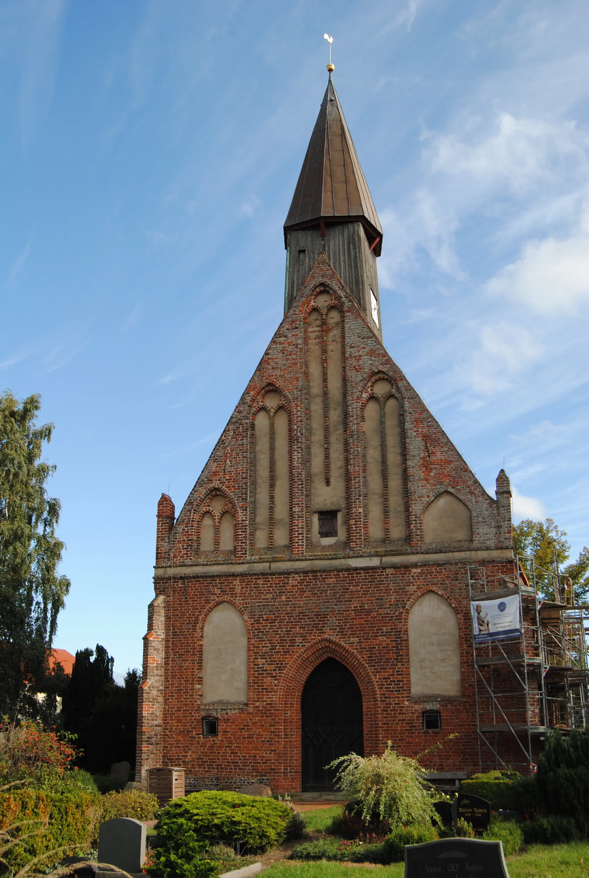
The fourth oldest place of worship on Rügen is a late Romanesque brick church from the 11th century. It has a Gothic superstructure. The present-day white nave dates from the 13th century, and the interior is Baroque. The squat square tower was added to the nave around 1500.
Bible verse of the day
Give us today the food we need to live. (based on Matthew 6:11)
Midday Meditation
At the moment, I carry everything I need on my back. It's amazing how little it can be. No wonder my normal everyday life exhausts me so much. Given all the ballast I carry around with me. How much is necessary? At what point does “need” begin? What is necessary? – “Give us today our daily bread.”
Evening Prayer
I have had enough to eat for today. I have a place to stay for today. I have enough strength for today. Today I live. God, help me to appreciate and honor the “today”. I do not need to worry about tomorrow. You will continue to give me what I need in the future. Thank you. Amen.

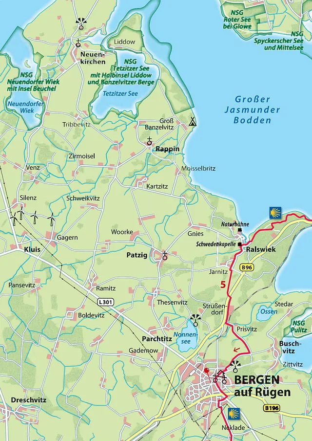
Hiking route (a variant) from Sagard to Bergen: This beautiful day trip, which mainly follows paths and minor roads, leads along the Großer Jasmunder Bodden over the Lietzower Dam and into the hilly countryside around Bergen.
Starting point: Sagard
Destination: Marienkirche in Bergen auf Rügen
Distance and time: 22 km, 6 hours
Address and contact details for accommodation
Bergen: Pilgrims' hostel, Billrothstr. 22, 18528 Bergen, tel. 03838 253873 (Pilgrim Mother) or tel. 03838 253524 (parish office), pilgerherberge.kirche-bergen.de, ten beds in three bedrooms, shower, kitchen. You can also get a pilgrim's stamp here. Price: 20 €, pilgrims: 10 €
Directions:
Opposite the left corner of the churchyard (with your back to the church), Capellerstraße leads down the hill, initially without a signpost. It crosses the country road (L30), which has a cobblestone pavement at this point. On the right-hand side, there is a Lidl, an Edeka supermarket and a Stolz department store. Capellerstraße crosses the country road and continues straight ahead on an unsurfaced road, passing a few rural houses and then across fields to Vorwerk. Turn right at the manor house, then, after about a kilometer, take a sharp left onto a footpath. The sign “Lietzow 5.3 km” cannot be seen from this direction. This is a wonderful rural path with reeds and the bay in the distance on the right. In Borchtitz, it leads across a grassland meadow where colorful flowers such as Kathäusernelken, Labkraut and Glockenblumen bloom in summer. The footpath ends at the road, where you first turn left and then right onto the path that leads up into the forest. Here, continue straight ahead following the green hiking trail signs.
Detour:
When the weather is good for swimming, we recommend taking the unsignposted right-hand path down to the Bodden at a fork in the road. There, a staircase leads to the water, which remains shallow for a long way. There is also a delightful path along the coast. However, the grounds of Villa Semper are fenced off right up to the edge, so there is no way through to Lietzow. You have no choice but to walk along the fence until you reach the castle-like former water tower, where the path meets the regular hiking trail again.
At the crossroads behind the former water tower, follow the signs to Lietzow. The now asphalted path winds its way to the shore of the bay. Turn left here, past a glassed-in call center, a restaurant that is not reliably open, and a water sports equipment rental. The beach is also tempting here. The promenade ends at the main road. On the other side, you will find the train station and a fish smokehouse. First, turn right and continue parallel to the main road and the tracks towards Ralswiek and Bergen. In summer, you will see a smokehouse boat in the lagoon on the right. Here, not only fish is sold from the boat, but guests can also eat it while sitting on the boat. Behind the dam, the pilgrims' path follows the green hiking signs to Ralswiek, turning right into the beautiful forest. The E10 hiking trail is well marked; if in doubt, head towards the Bodden coast on the right. About a kilometer before you reach Ralswiek, a path leads between the reeds and the high shore, where it meets the E10. After the red-and-white barrier, the path forks again and then comes together again. Where the asphalt begins, you can go right to reach Ralswiek after 100 meters via a footbridge. Here there are two thatched-roof picnic tables and the Café Riff (open daily from 2 p.m. from April to October, closed Mondays and Tuesdays). From June to September, Ralswiek is the venue for the Störtebeker Festival. In the entrance area of the festival grounds, there are numerous snack stands that only open before the start of the performances. Take the footbridge back to the pilgrimage route, which leads to the main road. Turn left there to reach the red Swedish chapel of Ralswiek.
St. Mary's Church (Bergen):
The second oldest church on Rügen should definitely be visited. It was built from 1180 by the converted Slavic king, Prince Jaromar I, and consecrated as a monastery and palatine church in 1193 by the Danish Bishop Absalon of Roskilde. You can take in the beautiful furnishings during a church service or concert. The mostly Romanesque wall paintings are the only example of a complete painting of a church in northern Germany. In the chancel, there are painted depictions of hell on the right and of paradise on the left. The tower clock face, which shows 61 minutes instead of 60, is also curious.
Morning Verse
A man considers his actions to be right, but the Lord weighs the motives of his heart. (Proverbs 21:2)
Midday Meditation
Lord, sometimes I don't know what is going on inside me. Much is confused or foggy. What motivates me? What lifts my spirits? It is good to know that you understand me even when I cannot make myself understood; that you give me meaning even when the external program feels meaningless; that you give me joy even when I am stuck in depressive moods. Make my path clear to me and let me arrive safely.
Evening Prayer
Now I have arrived – for today. My body is coming to rest, my heart too. You, God, know my heart. You know me, but you do not condemn me. I want to treat myself the same way. I keep getting to know myself anew and do not condemn myself. I arrive at you and at myself. In your and my peace. Amen.
Address and contact details for accommodation
Zudar: Pilgrim accommodation suitable for groups with kitchen, toilet, without shower (with sleeping bag and mattress) in the parish hall of the pilgrimage church, Dorfstraße 24, registration: Garz parish office, tel. 038304 257, garz@pek.de
Garz: Gasthaus & Pension Zur Post, Lange Straße 12, 18574 Garz, Tel. 038304 333, ruegen-gasthaus-zur-post.de, two double rooms and one triple room, Price: €30 per person
Garz: Hotel am Wiesengrund, Im Wiesengrund 23, 18574 Garz, Tel. 038304 347, ruegen-hotel-am-wiesengrund.de
Directions:
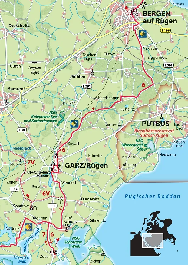
From the portal of St. Mary's Church, go down, then turn left into “Billrothstraße” and continue down the hill, past Billroth House (No. 17). Theodor Billroth, who was from Rügen, worked mainly in Austria and is considered one of the most important doctors of the 19th century. Cross the B196 at the traffic lights (you can stock up on provisions at the Edeka supermarket on the left) and continue straight ahead along Putbusser Chaussee until Straße der DSF branches off to the right. After 300 meters, follow the bike signs to Neklade on the left. In this cul-de-sac, go past the few houses, then turn left and right again onto the paved path along allotments and pastures to Neklade. In the small town of Neklade, go straight ahead. On cobblestone paths, shaded by trees, between meadows and fields, continue straight ahead, over a railroad crossing and into a larger forest, the “Klosterholz-Forst”. There is a shelter in front of it, one of the few places to sit on this stage. The Birgittenweg is not allowed to be marked in the private forest, but it is easy to find the way. Continue straight ahead until you reach a crossroads, where the pilgrimage route turns right towards “Güstelitz”.
Coming out of the forest, the path meets a village road, turn right here and then stay on the road for about 150 meters. After a left turn, you will see the red-painted “Forsthaus Ketelshagen” on the right-hand side, with a deer head above the front door. Opposite the forester's lodge, turn left (again with the pilgrim's sign) into the forest. At the fork, you will soon reach a hiking and biking trail that follows the former narrow-gauge railway line from Altefähr to Putbus. From 1899 to 1967, a narrow-gauge railway ran here, initially only for the transport of agricultural goods, but later also to bring holidaymakers to Göhren. Turn right at the narrow-gauge railway line. At Ketelshagen, the route rejoins the road, where you simply continue straight ahead. Often lined with trees, this path leads through the lovely hilly landscape of southern Rügen to just before Garz. At the marking, turn left behind the first house in Garz and then left along “Bergener Straße”. On the left side is the Catholic Church of the Sacred Heart of Garz. For the Protestant church, follow the right-hand bend in the road and, opposite the Edeka supermarket, continue across its parking lot into Wendenstraße.
St. Petri Church (Garz):
The Gothic brick church of the oldest town on Rügen dates from the 14th century and has a foundation of erratic boulders. Even older than the church is the granite baptismal font (over 700 years old) of unknown origin. After sustaining damage in a storm in the 17th century, the massive tower was given a flat dome.
Directions:
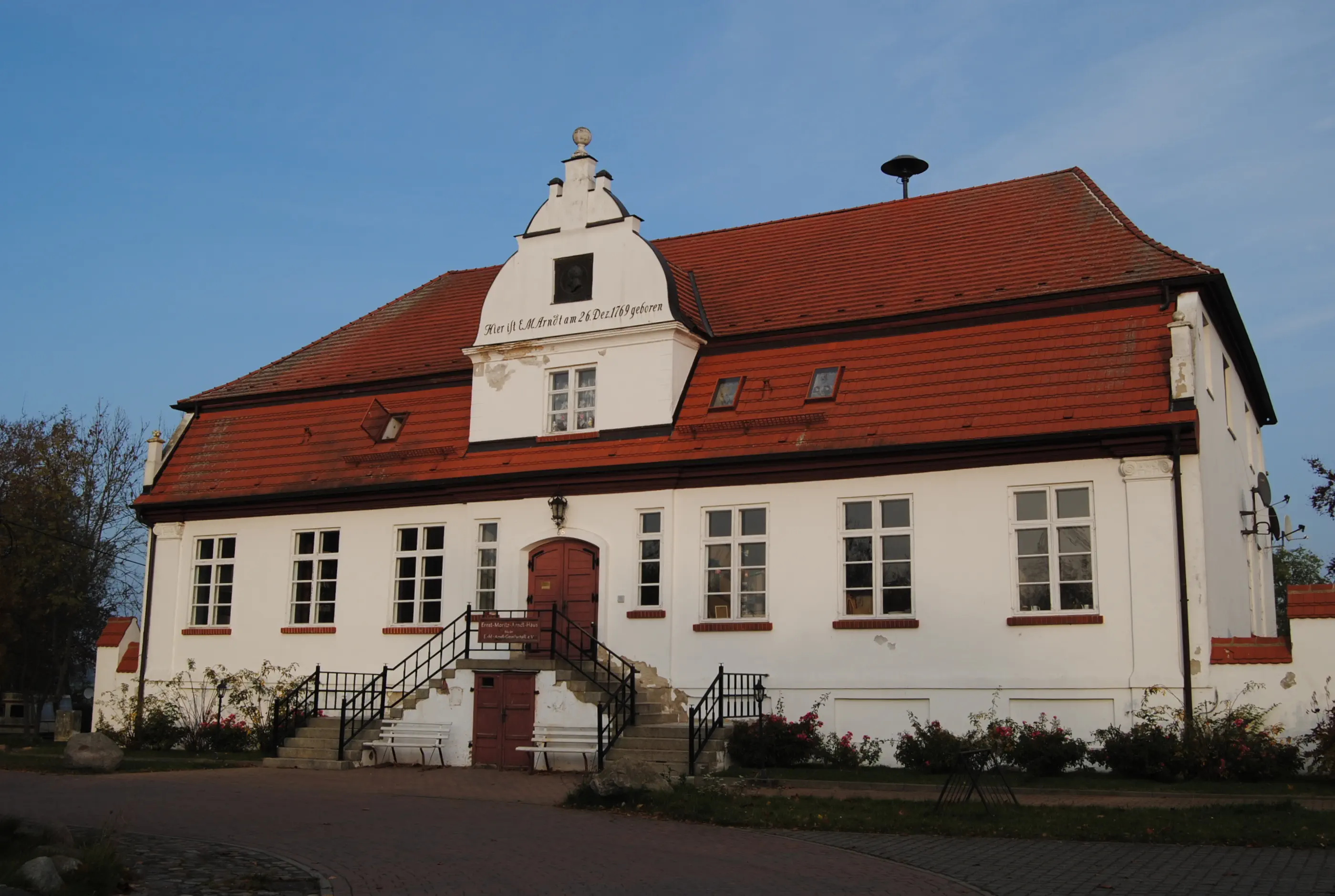
Coming from the Protestant church, first turn left onto Wendorfer Straße, then right onto Am Burgwall. At the end, turn left (the small but fine Ernst Moritz Arndt Museum is on the right) and walk along the former Slavonic fortress of Charenza. Today, only a tree-covered hill remains of the once fortified fortress. When Rügen was Christianized in 1168, it was the most important fortress, along with Arkona on Wittow, which Danish troops eventually overcame. After some verifiable attempts at conversion by various German religious orders, the Danish monks joined forces with an army of soldiers and overcame the Rügen Slavs, who had been considered invincible until then. Through the victory, the monks managed to convert the pagans. Continue along the castle wall, then along the shore of Lake Garz to about the middle of the lake. There the path turns left to Wendorf. Here on the country road (L30) turn right and after a few meters cross the road and continue straight ahead into the small village. On the path, continue straight ahead past the transformer tower, then the path turns right and a sign indicates “Silmenitz 3.5 km”. The path continues straight ahead along fields via Dumsevitz Ausbau (do not turn left to Dumsevitz/Silmenitz!) to Groß Schoritz, the birthplace of Ernst Moritz Arndt (1769-1860). There is a small public park with a bird-watching tower at the manor house. The pilgrimage route leads from Dumsevitzer Weg to the right along the country road back to the L30. Turn left here onto the roadside foot/cycle path via Klein Schoritz to Zudar, the town at the entrance to the peninsula of the same name. There is a small roundabout here, where a well-signposted path leads off to the left to the pilgrimage church.
Pilgrimage Church of St. Lawrence (Zudar):
A pilgrimage to Zudar to see the miraculous painting of the Virgin Mary was as valuable as a pilgrimage to Rome. But St. Lawrence, first mentioned in a document in 1318, did not function as a place of pilgrimage for long. After a pilgrim ship sank in the sound during a storm in 1372, pilgrimages were abruptly discontinued. The brick St. Lawrence Church, with its beautiful interior, is the southernmost church on Rügen and well worth a visit. The church is open during the summer months during the day.
Morning Verse
Lord, open my lips, and my mouth shall declare your praise. (Psalm 51:17)
Midday Thoughts
What have I already talked about today? I got annoyed about the conditions at the accommodation. I was annoyed that there were no fresh rolls. The weather is too cool and rainy. The forecast had said sunny. And I almost got hit by a car. I gave the driver a rude sign.
Lord, open my lips, that my mouth may declare your praise!??! I decide to smile now and say thank you: for my health; for a full stomach; for the silence around me; for the fact that it has stopped raining; for...
Thank God!
Evening Prayer
God, the day went better than I thought. Thank you! God, I have reached my goal for the day. Thank you! God, the accommodation is warm and dry. Thank you! God, I had something good to eat. Thank you! God, my legs did their job. Thank you! God, I had a nice chat on the way. Thank you! God, I'm alive. THANK YOU! Amen.

Hiking from the Zudar peninsula to Gustow:
This stage leads mainly on quiet roads, a little treeless, through the landscape of southern Rügen, which is characterized by large fields. Views of the extensive lagoon landscape can be enjoyed again and again.
Starting point: Zudar
Destination: Gustow
Length and time: 18 km, 6 hours
Address and contact details for accommodation
Gustow: Private accommodation for individual pilgrims with Mrs. Heublein, Gustow, Dorfstraße 1, by prior arrangement by telephone 038307 832, smoker's household
Gustow: Accommodation for groups in the village community hall, Am Mühlenberg 7, with advance reservation with Mr. Geissler, Tel. 0172 3077483, price: 75 € per night for the house with kitchen and toilet, sleeping mat and sleeping bag required.
Prosnitz (3 km from Gustow): Hotel Gutshaus Kajahn, Prosnitz 1, 18574 Gustow, Tel. 038307 40150, hotel-gutshaus-kajahn.de, single, double and four-bed rooms with bathroom, prices: from €43 per person in a double room
Venzvitz (near Poseritz): Familie Bürger/Otto, Venzvitz 18, 18574 Poseritz, Tel. +491624804696
Route:
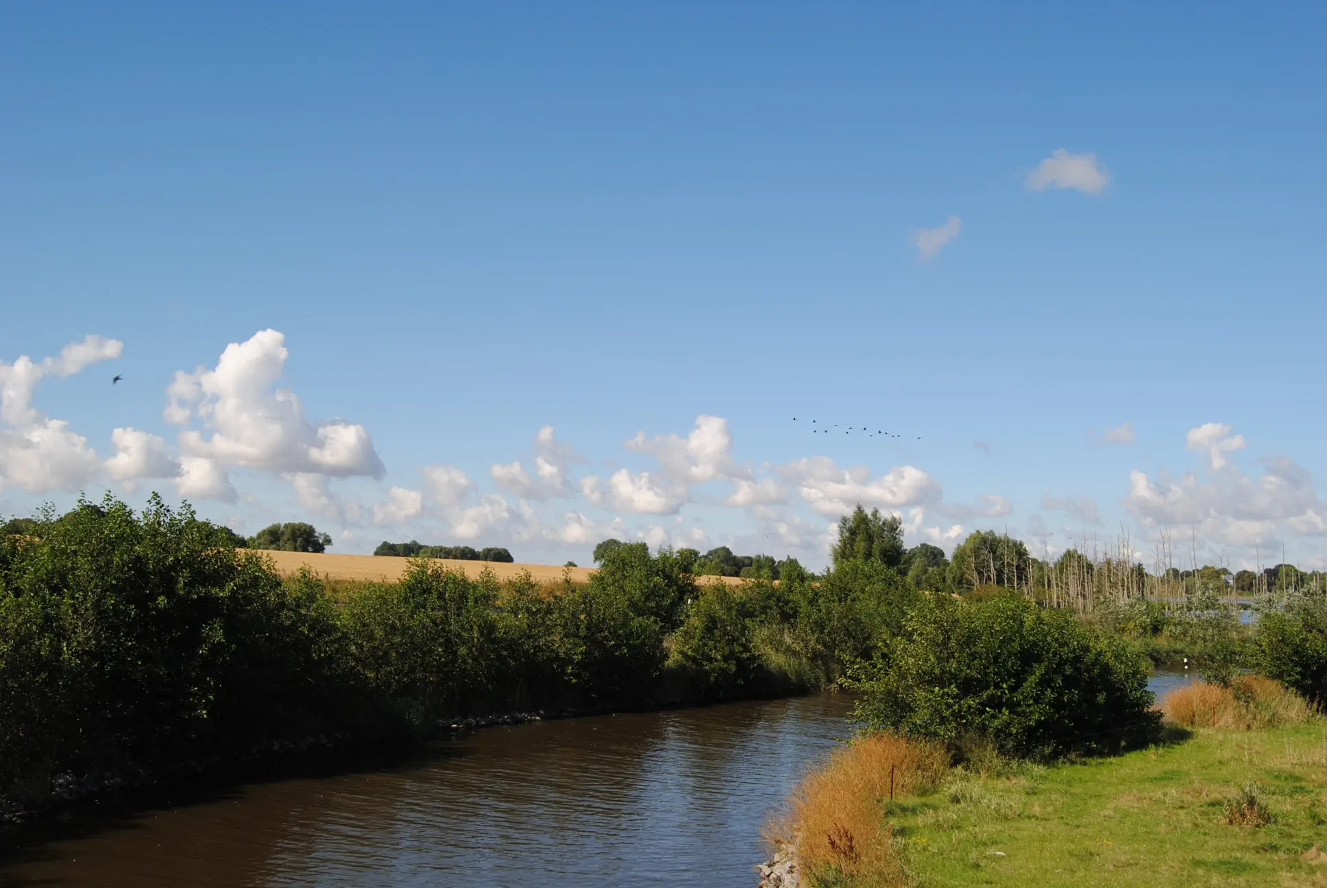
From the municipal hall in Zudar, the route initially runs along the village road, then along the side of the road for 2.5 kilometers back towards Garz. At the first junction, it turns left towards Puddemin. Shortly after the “Museumshof” with a wooden mouse sculpture on the unfortunately locked gate, a cycle and footpath branches off to the left. The route continues past Puddemin harbor, where a few sailboats are moored in summer. After a kilometer, the path crosses the road to Mellnitz. If you don't want to make a detour to the church of Swantow (see route description 7A), turn left here and walk along the road through the village of Mellnitz and then continue with wonderful views over the Üselitzer Wiek. The area was flooded in 2011 as a compensation area for the environmental damage that was accepted during the construction of the new Rügen bridge. A total of 240 hectares were renatured, which had been cut off from the Puddeminer Wiek due to the dike built in the middle of the 20th century. The trees that died as a result of the flooding date from this period. The shallow bay is used by birds for resting and breeding. The rare red-backed shrike, whinchat and wood lark are said to be native to this area. However, you can see mainly water birds such as gray and great white herons, white-tailed eagles, as well as wild geese and shelducks. The paved path leads past the Üselitz manor house, situated on a small peninsula, and then climbs slightly to the Glutzow settlement. In the hamlet with many horses, turn left at the first opportunity on the hilltop onto Dorfstraße, which descends slightly to Glutzow Hof. In Glutzow Hof, the road leads to the Poseritz-Venzvitz thoroughfare.
Detour:
If you want to visit the Poseritz church, turn right out of the settlement and then right again onto a dedicated foot and cycle path. Shortly before Poseritz, a path branches off to the left, which then curves around to become “Lindenstraße”. After crossing the main road (“Stralsunder-Straße”), a path leads up to the church. The same beautiful path leads back to Glutzow Hof. The detour is a total of five kilometers long. For more information on Poseritz, see route description 7A.
St. Marien Church (Poseritz):
Built around 1320, the brick church stands on a fieldstone foundation. The ribbed vaulting, the tower and the choir date from around 1450. During renovations in the 1980s, ornaments and wall paintings from different centuries were discovered under eleven layers of paint. However, the funds to uncover them are still lacking. The key to the church can be obtained from Mr. and Mrs. Prophet, Lindenstraße 19, in the house right next to the cemetery.
Directions:
If you don't want to make the detour, continue from Glutzow Hof at the crossroads to the left along the road to Venzvitz. In Venzvitz, turn sharp right onto a treeless paved path where cars rarely pass. The road leads about 1.5 kilometers through the rather monotonous large field economy before there is a small forest on the left side in a lowland. Behind it, a cycle and footpath turns off to the left, easily overlooked. This is the most beautiful part of the route on this stage. It is therefore worth turning back at the houses of Sissow if you have missed the “entry point” (also marked with a pilgrim sign). The narrow, tree-lined path leads along the large gardens of the Sissow houses, through a thicket and finally past a large horse pasture. At this crossroads, there is an opportunity to turn left down to the Kajahn manor house to eat game or have coffee, ice cream, etc. under a mighty oak tree (Kajahn manor house, hotel, café, miniature golf and game shop, Prosnitz 1, 18574 Gustow, phone: +49 (0) 38307 40150,hotel-gutshaus-kajahn.de, opening hours: April to October, Sat and Sun from 12 noon; the owners live nearby and also cater for guests outside of opening hours by prior arrangement by telephone). If you don't want to walk down to the manor house, stay on the foot and cycle path to Gustow. Here you cross the gravel parking lot, cross the main road and then walk along it on the right. On the left, the snack bar “Zum Reiter” offers sausages, baked fish and cold drinks. On a hill to the right of the main road stands the Gustow church. On the left is the “Naturinsel”, a shop run by the Insel e.V. workshop for disabled people. During normal business hours, except on Saturdays, regional organic goods, homemade cake and coffee are available here.
Gustow Church:
The small church on the hill was built in several stages between 1314 and 1517. In 1935, wall paintings were discovered, some of which have since been uncovered. Among them is a figure signed “Taddäus”. The insignia of a pilgrim's hat, staff and banner suggest a depiction of St. James. In any case, they indicate that the Gustow church was once a pilgrimage church. In the cemetery stands the “Mordwange”, a tall, weathered stele with seven circularly arranged points at the upper end. It was probably erected in 1510 as a memorial for a murder committed at this place. It is also called a “Sühnestein” (atonement stone) and was supposed to bring satisfaction to the relatives. The inscriptions, some of which still exist, have not been deciphered. In addition to the Mordwange in the Gustow cemetery, there is another one on Rügen in Schaprode. You can get the key to the church at the end of the village in the former parsonage from Frau Heublein, Dorfstraße 1, or in the house opposite the cemetery, Kirchweg 1.
Thought in the morning
The vastness of the landscape – the vastness of my thoughtsI step out of my narrow, often repetitive thought patterns. I give myself the freedom to think beyond my limitations. I feel hesitation and uncertainty. Freedom is exhausting. I allow myself time to search for the right path in this new expanse.
Midday Prayer
LORD, our Lord! The whole world reflects your majesty. The heavens are a sign of your glory and power. From the mouths of children and infants you have made your praise resound. It is stronger than the cursing of your enemies. Their vengeance is paralyzed; they are put to shame and fall silent. I look up at the sky and see what your hands have created: the moon and the stars – you have assigned each one its place. What is man that you are mindful of him? How small and insignificant he is, and yet you care for him. You have made him only a little lower than the angels; indeed, with glory and honor you have crowned him. You have put everything under his feet: the sheep and the cattle, the wild animals, the birds of the air, the fish of the sea, all that travel the paths of the seas. Lord, our Lord, how majestic you are! The whole world is full of your glory.
Evening Prayer
God, I am concerned about the “murdered cheek” in the cemetery. A sign of violence and a sign of atonement. I think of “open cases” in my life. I have hurt. I have been hurt. It gnaws at me. I cannot find peace about it. I'll tell you. Maybe then I'll find the strength to tell others. – Thank you for listening, God. Amen.

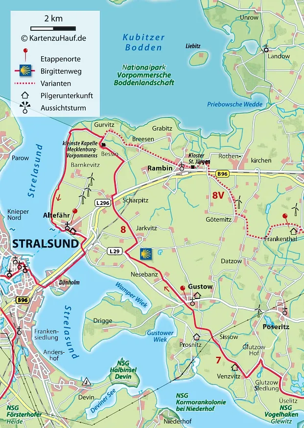
Hike from Gustow to Altefähr: Initially on the old narrow-gauge railway line, the route crosses a gated railroad crossing and then leads over fields and meadows to the Strelasund, the strait that separates Rügen from the mainland.
Starting point: Gustow
Destination: Altefähr
Length and time: 18 km, 6 hours
Address and contact details for accommodation
Altefähr: The Protestant parish of Altefähr recommends the Rüstzeitenheim Rügen, Bahnhofstraße 20, 18573 Altefähr, with registration, ruestzeitenheimruegen@gmx.de, bunk beds (with bedding available for a fee), shower, toilet and kitchen, price: from 15 €.
Directions:
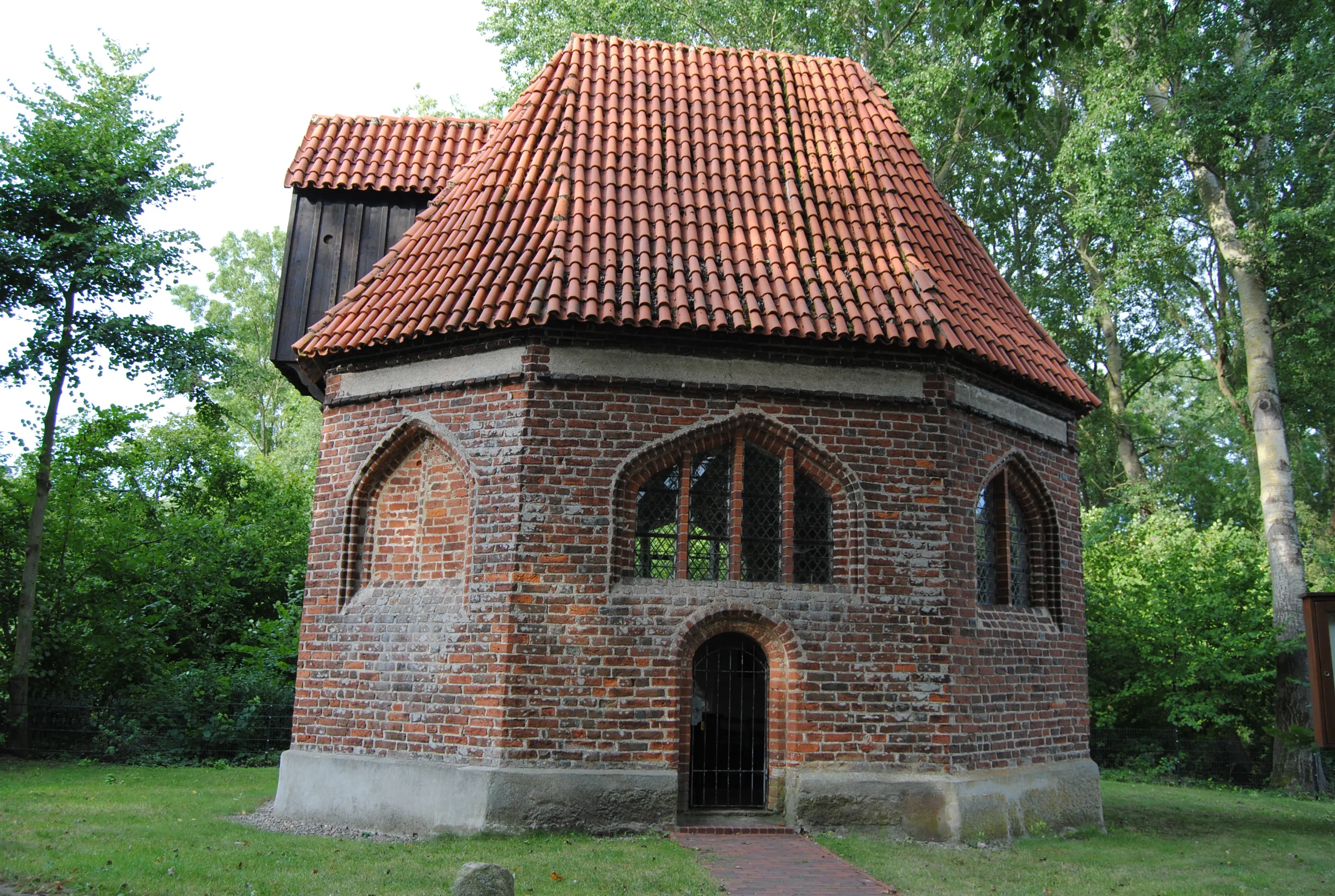
From the church in Gustow, go back along the main road and then turn right at the next opportunity into “Nesebanzer Weg”. Before the snack bar “Zum Reiter”, turn left and continue along “Nesebanzer Weg” through a residential street. This leads into a little-used tarred road that passes a hiking shelter and descends over the hill into the settlement of Nesebanz. There it goes left and then, after about 50 meters, immediately right again onto a dirt road, on which you can walk across the fields to the country road (L29). A roadside foot and bike path begins on the same side here. After 200 meters, this leads to the turnoff on the right to Jarkvitz. The paved path runs slightly uphill to the larger settlement of Jarkvitz. Before the first house, a gravel path branches off to the left without a sign. It leads across the fields a little downhill to a gated railroad crossing, where you have to press the yellow button under the loudspeaker to open the gates. Through the village of Scharpitz, the cars on the new federal highway (B96n) are routed through an underpass. A bridge leads over it, the old federal highway behind it can simply be crossed. Here you turn right, past the shop for water, wind and kayaking, and after about 250 meters turn left onto a very smooth paved path. This leads along a windbreak hedge through the fields to the next turnoff on the left with the sign “Bessin”. The path inevitably leads to the smallest chapel in Mecklenburg-Western Pomerania. There is also a pilgrim's stamp with an ink pad inside. The round bench in front of it invites you to take a break. The route then continues back a little way to the crossroads. Behind the last house in Bessin, another paved path branches off to the left with the sign “Altefähr 6.7 km”. Follow this, it leads directly to the coast. Passing a navigational aid, the path narrows to a trail, veers left and now continues along the coast, mostly with a windbreak hedge between the trail and the Strelasund. The natural landscape at the beginning belongs to the Western Pomerania Lagoon Area National Park. Parts of the neighboring islands of Zingst and Hiddensee and a lot of water surface belong to this 78,600-hectare national park, where nature may only be interfered with by the national park administration. About a kilometer before Altefähr, you can also walk on the sandy strip and go swimming in the sound. Always along the water's edge, the blue-painted restaurant “Strandhaus” is the first building in Altefähr. Further along the small bathing cove and on the elevated wooden walkway, you can already see the steeple of the Altefähr church. Through the harbor, you will pass an Italian restaurant and arrive at the harbor master's office, in front of which there is a large wooden sculpture of a ferryman. To the left of the building, a pedestrian path winds up to the church hill.
St. Nikolai Church (Altefähr):
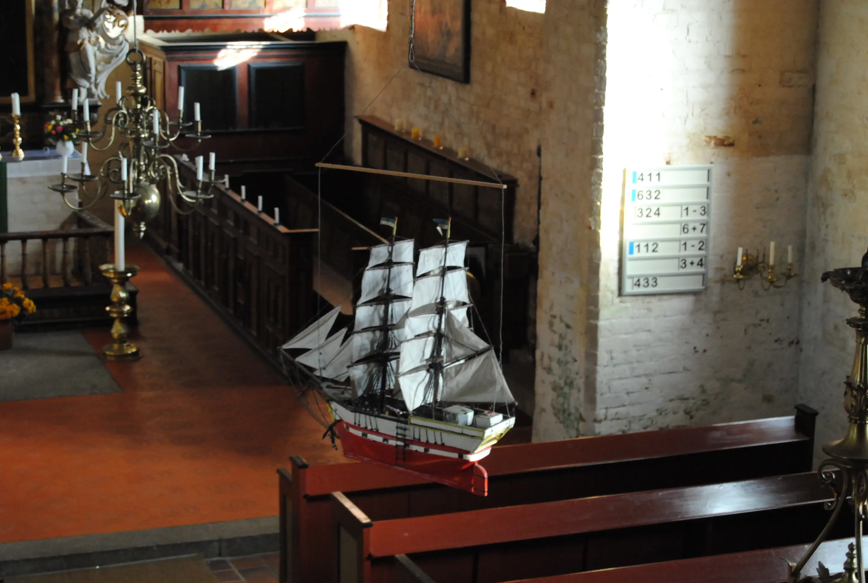
The old seafarers' church stands directly above the ferry dock and is a real gem. The oldest parts of the building date from the 15th century. Its interior is richly decorated with valuable wall and ceiling paintings and several votive ships. The church was painted at the end of the 17th century. A carved inscription refers to the year 1737, and the present-day barrel vault of the nave was probably added during a renovation. The gabled roof, which still exists in this form today, was also constructed in this year. The tower, which collapsed in 1803, was rebuilt and extensively renovated in 1912/13. The altar shows an inverted copy of the Last Supper by Paul Peter Rubens (1577-1640). There is a pilgrim's stamp in the church.
Directions:
Follow Kirchweg along the cobblestone road, passing the church on your right. Turn right at the small supermarket “Dit und dat” and continue for about 200 meters. The parsonage is on the right-hand side. The Rüstzeitenheim is directly behind it.
Morning Prayer
A person who lives according to God's word is like a tree planted by water. It is well cared for even in dry seasons. It bears fruit in its season and its leaves do not wither. Everything it begins, it succeeds in. (based on Psalm 1)
Midday Thoughts
I make my way through fields and past gardens. Growth and harvest in its time. Sowing and planting with the trust that the rain and sun will come at the right time.
Evening Prayer
God, I desire deep roots. A firm footing and a good supply of everything I need to live. I desire inner growth and a fruitful life. I can do my part. But growth and prosperity are in your hands. I await your work with serenity. Amen.
Address and contact details for accommodation
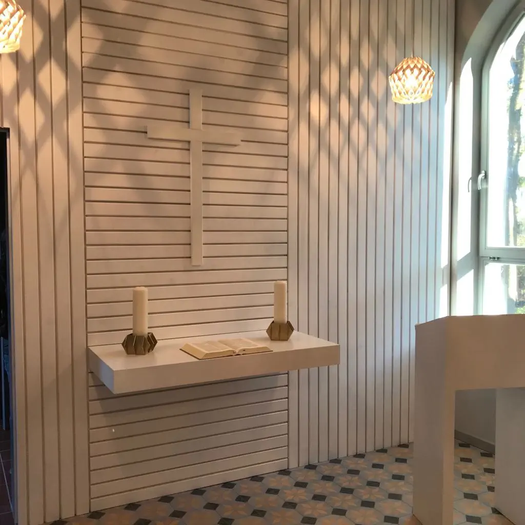
Swantow: Epiphanisas Chapel in Swantow, 18574 Swantow, please register by phone a few days in advance, tel. 038307 40102 (Angelika Schäfer), kitchen and toilet available, no shower, overnight stay with sleeping mat and sleeping bag, price: a donation is requested.
Swantow: Larkens/Miraß family, Swantow vicarage, 1, 18574 Swantow, tel. 0049 38307 479943, holunderbar@web.de, overnight accommodation in the Quittenstübchen, 1 double bed, bathroom, kitchen, price: €15 per person.
Garz: Gasthaus & Pension Zur Post, Lange Straße 12, 18574 Garz, Tel. 038304 333, ruegen-gasthaus-zur-post.de, two double rooms and one triple room, Price: €30 per person
Garz: Hotel am Wiesengrund, Im Wiesengrund 23, 18574 Garz, Tel. 038304 347, ruegen-hotel-am-wiesengrund.de
Directions:
From the portal of St. Mary's Church, go down, then turn left into “Billrothstraße” and continue down the hill, past Billroth House (No. 17). Theodor Billroth (1829-1894) from Rügen worked mainly in Austria and is considered one of the most important doctors of the 19th century. Cross the B196 at the traffic lights (you can stock up on provisions at the Edeka supermarket on the left), and continue straight ahead along Putbusser Chaussee until Straße der DSF branches off to the right. After 300 meters, follow the bike signs to Neklade on the left. In this cul-de-sac, go straight ahead behind the few houses, then turn left and right again along the paved path past allotments and pastures to Neklade.
In the small town of Neklade, go straight ahead. On cobblestone paths, shaded by trees, between meadows and fields, continue straight ahead, over a railroad crossing and into a larger forest, the “Klosterholz-Forst”. There is a shelter in front of it, one of the few places to sit on this stage. The Birgittenweg is not allowed to be marked in the private forest, but it is easy to find the way. It goes straight ahead until a crossroads, where the pilgrimage route turns right towards “Güstelitz”. Coming out of the forest, the path meets a village road, which you follow to the right for about 150 meters. After a left turn, you will see the red-painted “Forsthaus Ketelshagen” on the right-hand side, with a deer head above the entrance door. Opposite the forester's lodge, turn left (again with the pilgrim's sign) into the forest. At the fork, you will soon reach a hiking and biking trail that follows the old Altefähr-Putbus narrow-gauge railway line. Turn right here. At Ketelshagen, the route rejoins the road, but simply continue straight ahead here. Often lined with trees, this path leads through the lovely hilly landscape of southern Rügen to just before Garz. At the marking, the path turns left behind the first house in Garz and then left along “Bergener Straße”. On the left side you will pass the Catholic Church of the Sacred Heart. Exhibitions occasionally take place there in the summer. For the Protestant church, follow the right-hand bend and, opposite the Edeka supermarket, continue across its parking lot into Wendenstraße.
St. Petri Church (Garz):
The Gothic brick church of the oldest town on Rügen dates from the 14th century and has a foundation of erratic boulders. Even older than the church is the granite baptismal font (over 700 years old) of unknown origin. After sustaining damage in a storm in the 17th century, the massive tower was given a flat dome.
Directions:
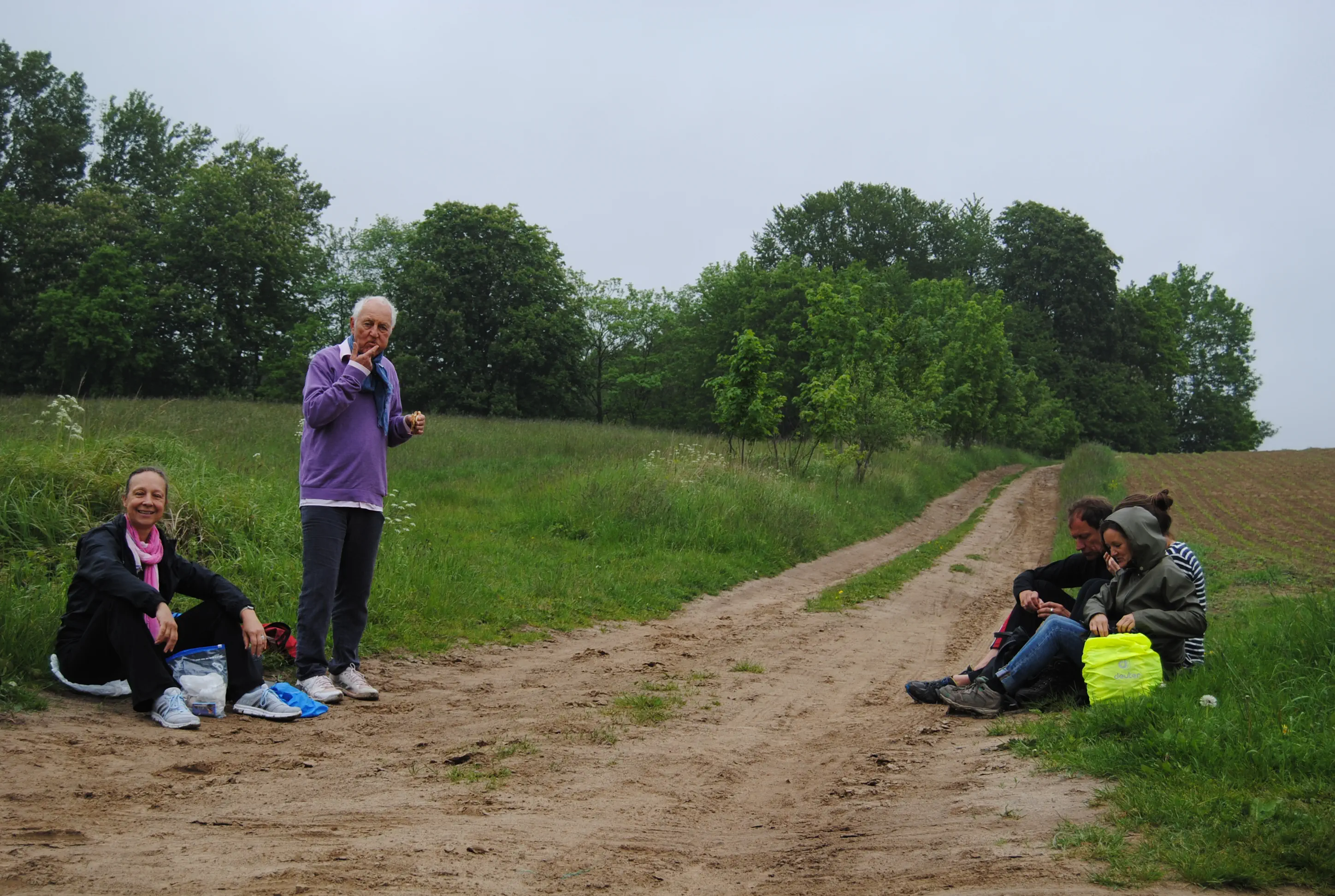
The official St. Bridget pilgrimage route leads out of Garz on the country road (L29). Given the current traffic, it is not recommended, especially since there are two narrow left-hand bends that cannot be seen by oncoming motorists. We therefore recommend the following alternative route to Swantow: coming from the church, first turn right into Wendorfer Straße, then left into Am Burgwall. At the end, turn left (you will see the small but fine Ernst Moritz Arndt Museum on your right) and continue along the former Slavic fort of Charenza. Today, only the tree-covered hill remains of the once fortified fortress. At the Christianization of Rügen in 1168, it was the most important fortress next to Arkona on Wittow, but the Danish troops finally overcame it. After several documented attempts at conversion by various German religious orders, the Danish monks joined forces with an army of soldiers and overcame the Rügen Slavs, who had until then been considered invincible. Through their victory, the monks managed to convert the pagans. The route goes along the castle rampart, then along the shore of Lake Garz to about the middle of the lake. Here the path swings left to Wendorf. Now follow the straight country road (L30) for 1.1 kilometers to the intersection where you turn left to Rosengarten and right to Renz. The pilgrimage route turns right through Renz and then left at the first opportunity into Swantow.
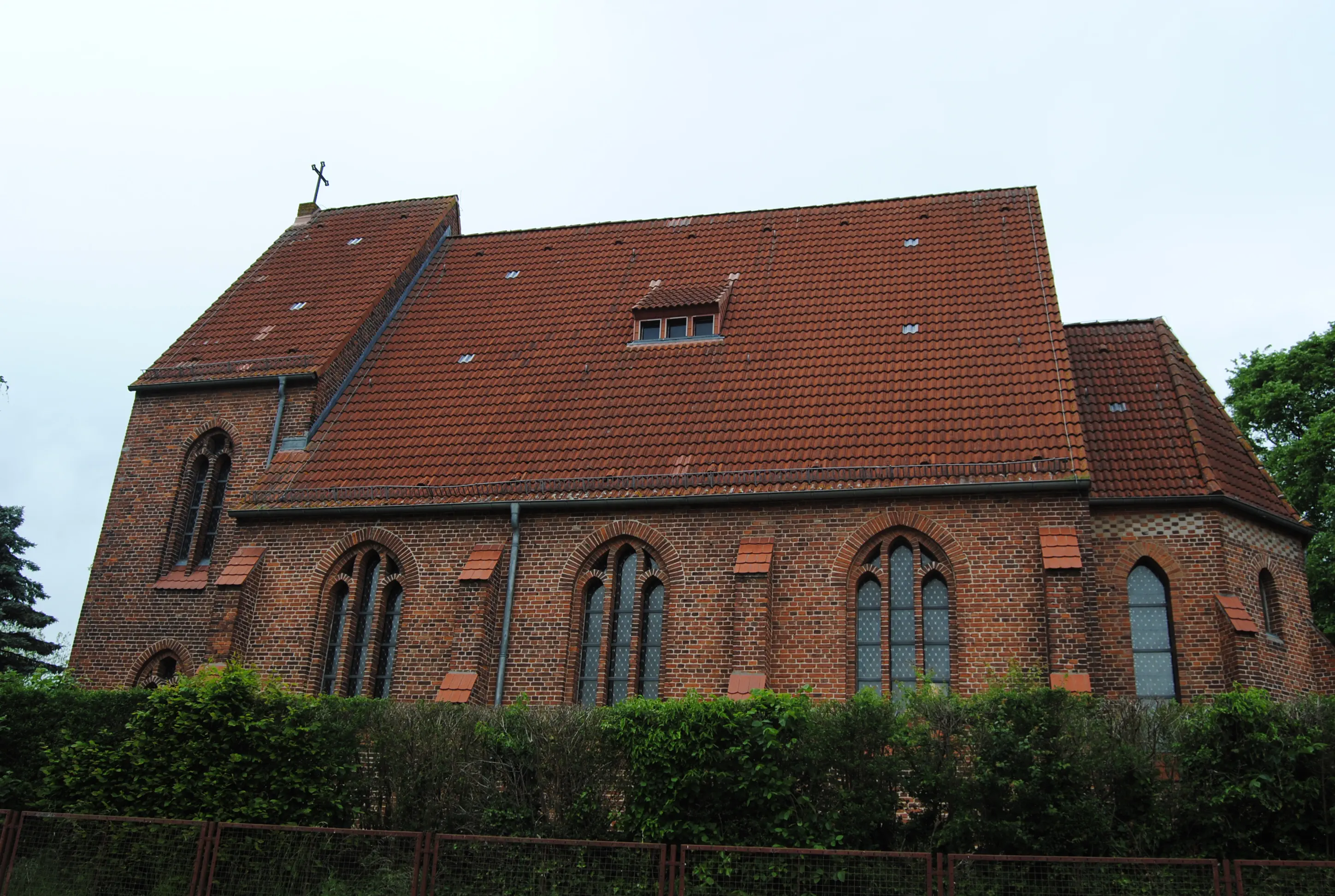
St. Stephen's Church (Swantow):
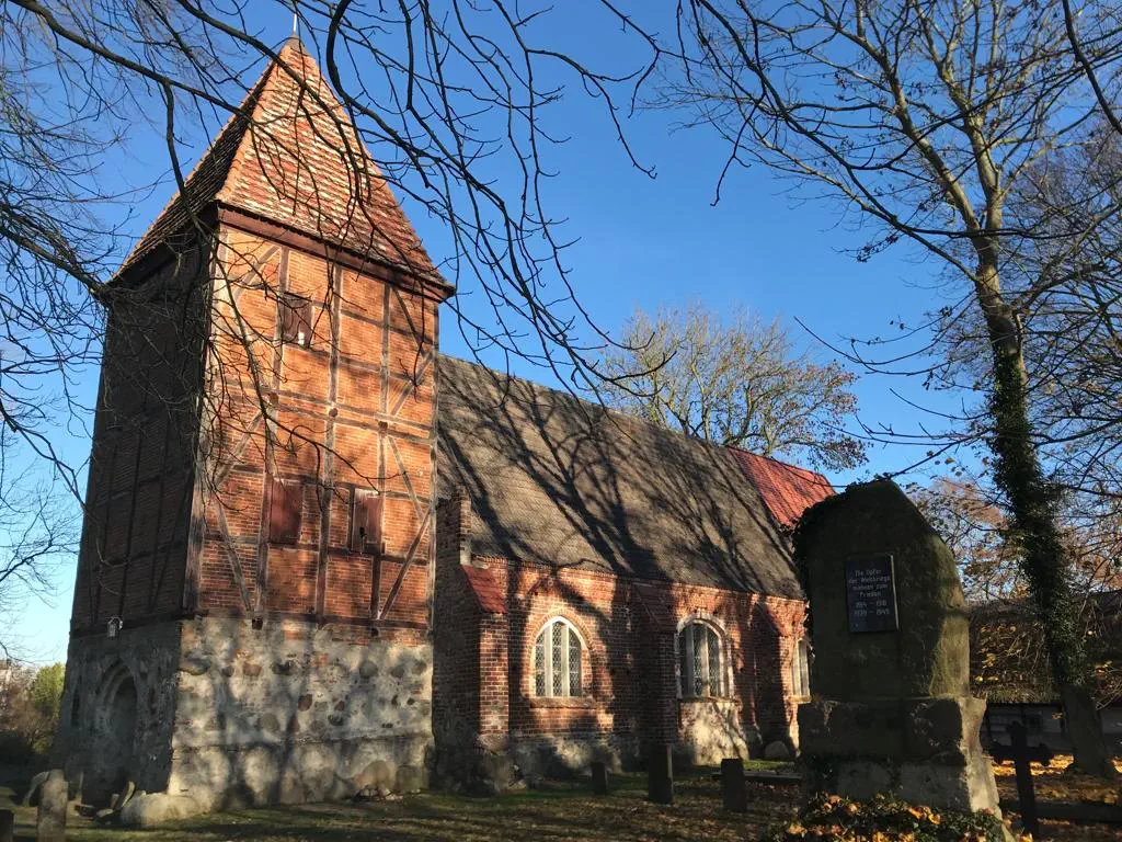
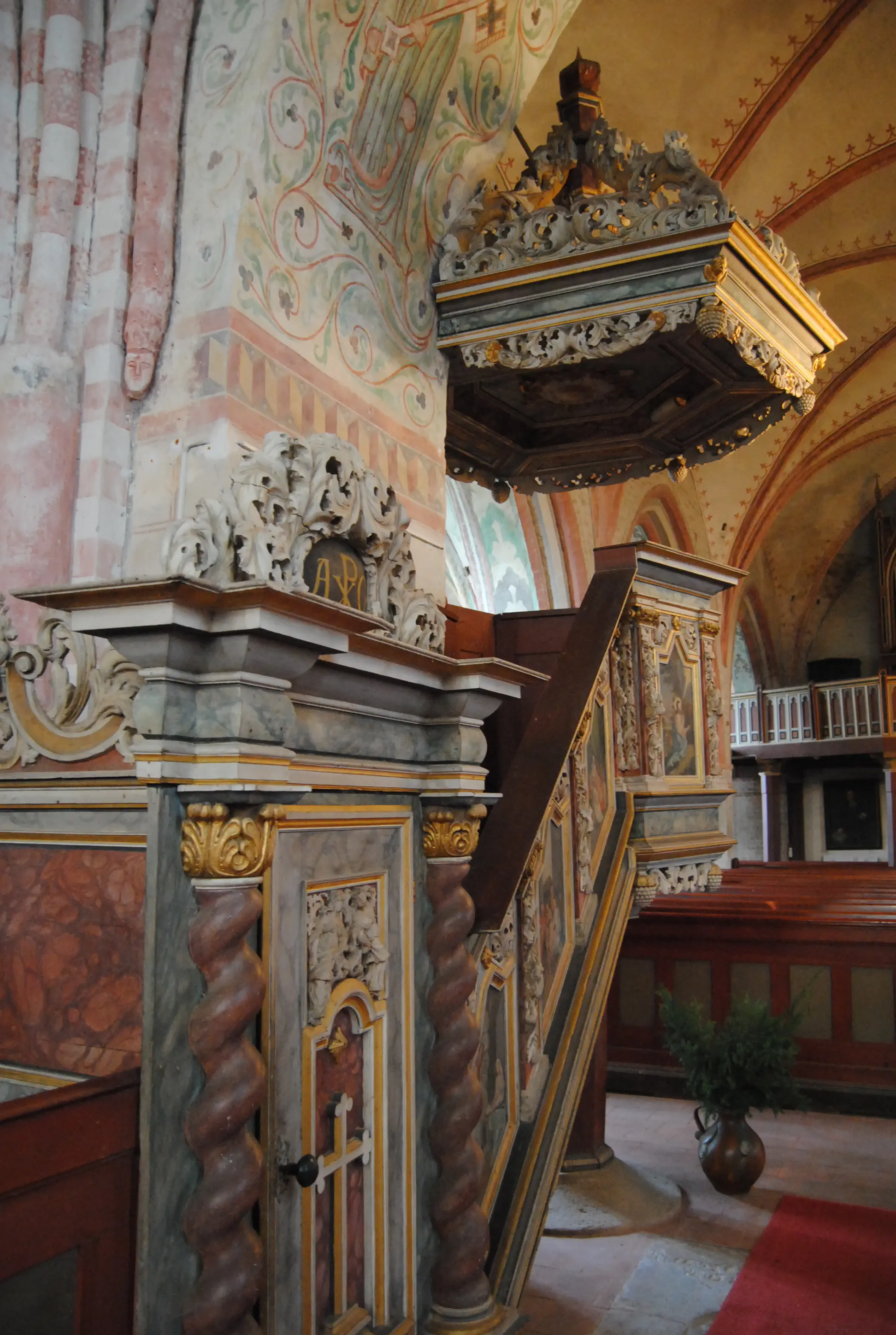
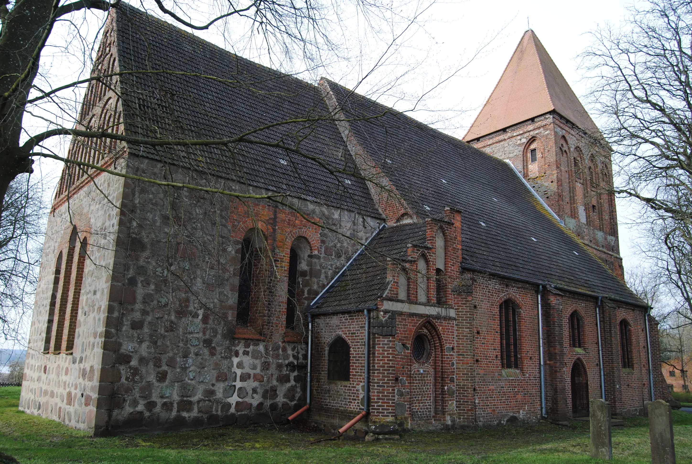
The Slavic name “Swetagora” means “holy mountain”. The name suggests that there must have been a cultic site for the Slavic inhabitants here before the church was built. In 1168, the Slavs were Christianized by the Danes. It is likely that there was a previous building in Swantow. The present brick church with inserted field stones dates from the 15th century. The west tower was added later. During the French occupation in 1811, the church was used as a grain store.
Morning Verse
Even though I walk through the valley of the shadow of death, I will fear no evil, for you are with me, Lord. Your rod and your staff, they comfort me. (Psalm 23:4)
Midday Thoughts
I keep my eyes on the path in front of me, a few meters away, so that I don't trip. So I trot along, my thoughts going round in circles. The sun breaks through the clouds in front of me. I lift my eyes and see the beauty of the landscape – the expanse, the colors, the light. – Hope. I am grateful.
Evening Prayer
God, the wide sky above me inspired my thoughts. The wind in my hair set me in motion. The sun on the wide landscape gave me light to my very core. Thank you for this day. Amen.

Alternative route from Swantow to Frankenthal: This alternative is a short stage for pilgrims who need a break after some of the longer daily marches. The chalk quarry lake of Klein Stubben is one of the island's lesser-known jewels.
Starting point: Swantow
Destination: Frankenthal
Distance and time: 8 km, 3 hours
Address and contact details for accommodation
Frankenthal: Pilgrims' accommodation LebensGut Frankenthal e.V., Frankenthal 7, 18573 Samtens, phone: +49 (0) 38306 230370 or Elke Neugebauer, phone: +49 (0) 174 9092 078, lebensgut-frankenthal.de, sleeping in a Mongolian ger, toilet, no shower, club kitchen can be used, organic catering on the premises, meals on request, price for overnight stay: 15 € per person
Directions:
In Swantow, you first follow the village road back towards Renz and Garz for a short distance. Soon after the Swantow town sign, follow the sign for Zeiten to the left. The small road crosses the Alte Bäderstraße (L29) between Poseritz and Garz in Zeiten. The pilgrimage route runs along the country road out of the village of Zeiten. The paved path climbs up to the 29-meter-high Kalkberg and then drops again at a considerable incline. Continuing on this paved path, the next hill is the Klein Stubben chalk quarry lake. Chalk mining on Rügen reached its peak between 1860 and 1900, with over 30 chalk factories and many small and large quarries.
It is worth knowing that chalk from Rügen has nothing to do with the school chalk we are familiar with. The multiplication tables and letters in the alphabet are written on the blackboard with gypsum. The chalk from Rügen comes from the heyday of the dinosaurs, the Cretaceous period, and consists of limestone deposits. Until the Second World War, it was used primarily in cement production. This changed with the further development of chemical products. Between 1950 and 1990, it was used, among other things, as a filler in the cable industry for insulation, as a component of PVC pipes, imitation leather and foils. It was also an indispensable component in the production of porcelain and stoneware, including sanitary porcelain and wall and floor tiles. Today, fossil lime from Rügen is only used in the wellness and cosmetics industry.
Walking along the paved path, the lake appears on the left behind a red and white barrier. There is a path along the shore that goes all the way around the lake. At a dead end between the two arms of the lake, a bathing area invites you to take a dip. In some places, the chalk shimmers brightly at the edge.
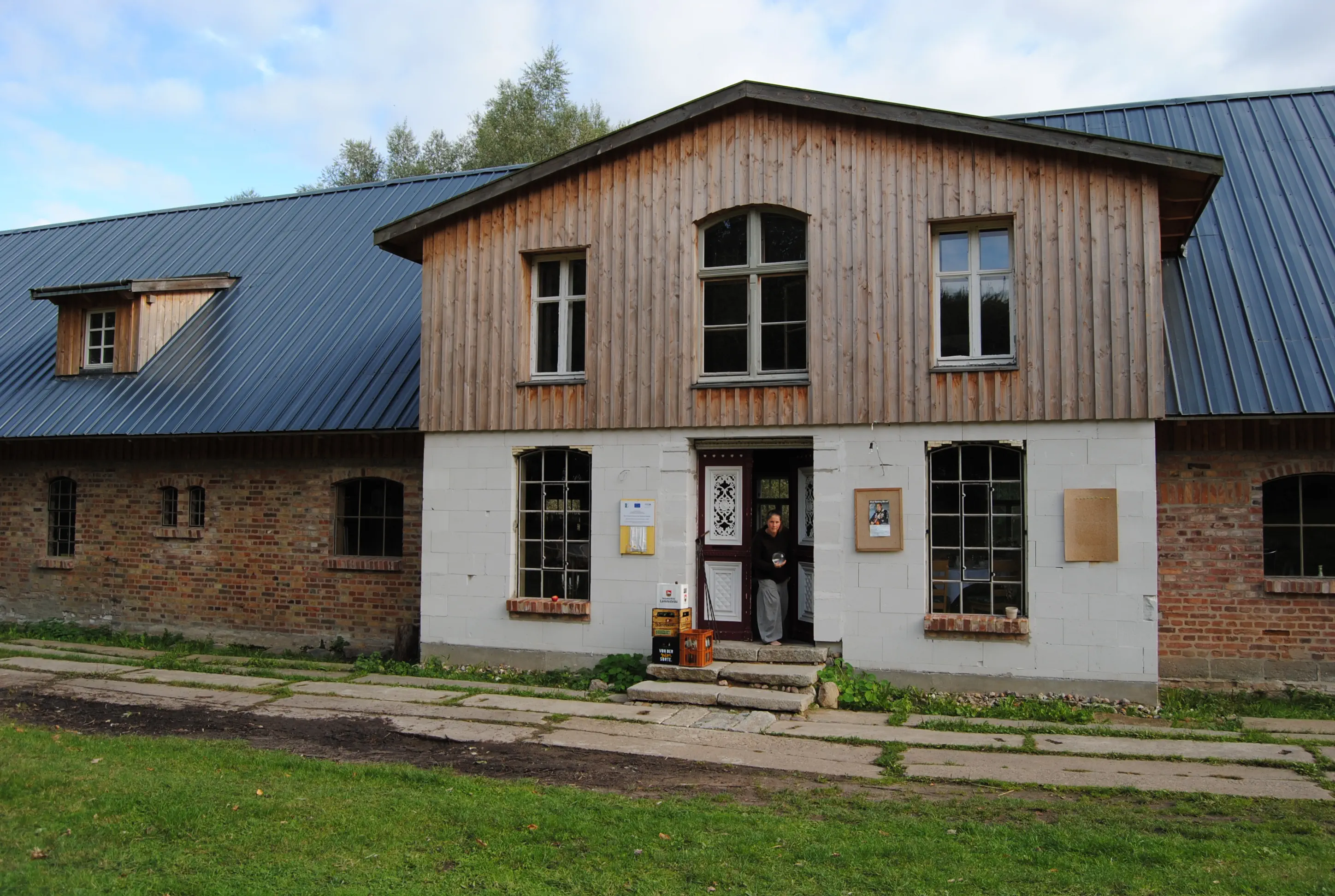
Either you walk around the lake or you follow the paved path, in either case to the Forsthaus Garz guesthouse, which is not far from the shore. An unpaved path leads past the guesthouse and across the fields. It comes out in a lowland and meets the road between Samtens and Poseritz. Turn right here and continue for about two kilometers until an access road to Frankenthal turns left. Then continue straight ahead, with a gentle left turn up and through a short stretch of chestnut avenue that leads to the manor house. The clubhouse of the LebensGut Frankenthal association is to the left of it.
Morning Verse
Heal me, Lord, and I will be healed; save me and I will be saved. (based on Jeremiah 17:14)
Midday Prayer
What does it mean to be whole? Or healed? God, I want to be whole, in balance, in harmony. Not just functioning. I want energy flowing through my body and my soul rejoicing. I want to live a life of strength. A life that is whole. A life from you! Give me this wholeness. Amen.
Evening Prayer
From him and through him and to him are all things. To him be the glory for ever and ever! Amen. (based on Romans 11:36)

Alternative route from Frankenthal to Altefähr: This day's pilgrimage through the south of Rügen is characterized by agriculture and farms with large gardens. When the Strelasund appears at the end of this stage, you have walked across the largest island in Germany.
Starting point: Frankenthal
Destination: Altefähr
Length and time: 22 km, 7 hours
Address and contact details for accommodation
Altefähr: The Protestant parish of Altefähr's retreat home, Bahnhofstraße 20, 18573 Altefähr, with registration, ruestzeitenheimruegen@gmx.de, bunk beds (bedding available for a rental fee), shower, toilet and kitchen available, price: from 15 €.
Directions:
From the door of the pilgrim accommodation in Frankenthal, the route initially goes back to the chestnut-lined access road. The road soon forks. Turning left, you pass a few small courtyards before the asphalt ends and a gravel path begins, rising slightly. It winds through the agricultural hills down into a hollow, where it can be muddy after rainfall. Then it climbs again and finally ends before Götemitz at a paved, small road. Here the path branches off to the right, past a bench that consists of an enormous tree stump with a backrest mounted on it. Götemitz consists of a few farms with beautiful gardens and a manor house that is privately used. The asphalt road turns into a paved path in front of it. At a shelter (a former bus stop), the path branches off to the right, and after a large field, more pretty farmsteads follow. Behind them, the road, which is not very busy, turns to the left and leads to the two federal highways and the train tracks, passing trees and bushes. The roads have to be crossed over a bridge. On the other side, turn right at the foot of the bridge, with the main road behind you. After about 100 meters, a paved path branches off to the left. It leads over a stream and into Rambin.
Side trip:
Behind the town sign, there is an opportunity to turn left almost to the main road. This is where the St. Jürgen Monastery of the Hanseatic City of Stralsund is located. Founded in the 14th century, nuns initially cared for plague victims here who were not supposed to remain in Stralsund. But soon it became a probationary institution, i.e. old and single people could buy into it as farmers and move into a small apartment with a garden for their own use. There was also a shared orchard. The people there lived quite well cared for until they died. The manager of the residence lived in the chapel very early on. Larger estates were donated all around, and the residents benefited from the rental income as part of their maintenance. It was, so to speak, a retirement home for the middle class. The apartments in the residence building are rented out today, but the chapel is unused. Back at the Rambin town sign: On the right-hand side, you can soon see a football pitch, followed by meadows, a reed belt and finally water. It belongs to the Kubitz Bodden. The entire water area and parts of the coast belong to the Western Pomerania Bodden Landscape National Park, which covers 768 square kilometers and is the third largest national park in Germany. About half of its area is open Baltic Sea, also includes Bodden waters and narrow strips of land from Rügen and Hiddensee, as well as a large part of the neighboring island of Fischland-Darß-Zingst. The national park is the highest classification of the protected areas designated in Germany. Here you are not allowed to leave the paths, pick or harvest anything, or bring anything into the park. But you can enjoy nature or – in this case – the beautiful views of the Bodden.
The “Neue Straße” turns off to the left shortly after the football pitch. At the end of this road, the steeple of the Rambin church can already be seen on the right.
St. John's Church (Rambin):
The first mention of Rambin Church dates back to the year 1300, making it one of the oldest churches on the island of Rügen. The addition of the sacristy and the expansion of the nave, however, have significantly altered the church. It is not documented when the wooden tower was added. Overall, the source material on the building's history is very thin. The original Gothic interior was redesigned in Baroque style around 1700, a curved wooden ceiling was installed and the west gallery was built in. In the 18th century, the south and north galleries were added,
the latter was considered a patron's lodge. During the renovation around 1990, under the guidance of restorers, some Rambin citizens repaired the ceiling and chairs and repainted it. The “Dorfstraße” runs along the church wall. If you walk along it, you will eventually cross the “Grabitzer Straße”.
Detour:
From here, turn left and cross the main road to find the Pommernkate restaurant with a wide range of dishes and, next door, the Rügener Insel Brauerei, where you can find many locally brewed craft beer varieties: Alte Pommernkate (open 7 am–7 pm) and Rügener Insel Brauerei (open 10 am–7 pm), Hauptstraße 2, 18573 Rambin.
Back to the Grabitzer Straße turnoff:
The village ends here. Ignore an ugly blue warehouse on the left – turn left if coming from the Pommernkate, otherwise go straight ahead – now on a paved path to Breesen. The view extends to the water, fields and small groves alternate. The path runs through the village of Breesen and on to Gurvitz, which consists of only four houses. Behind them, the quiet road swings around to the left and continues straight ahead to Bessin.
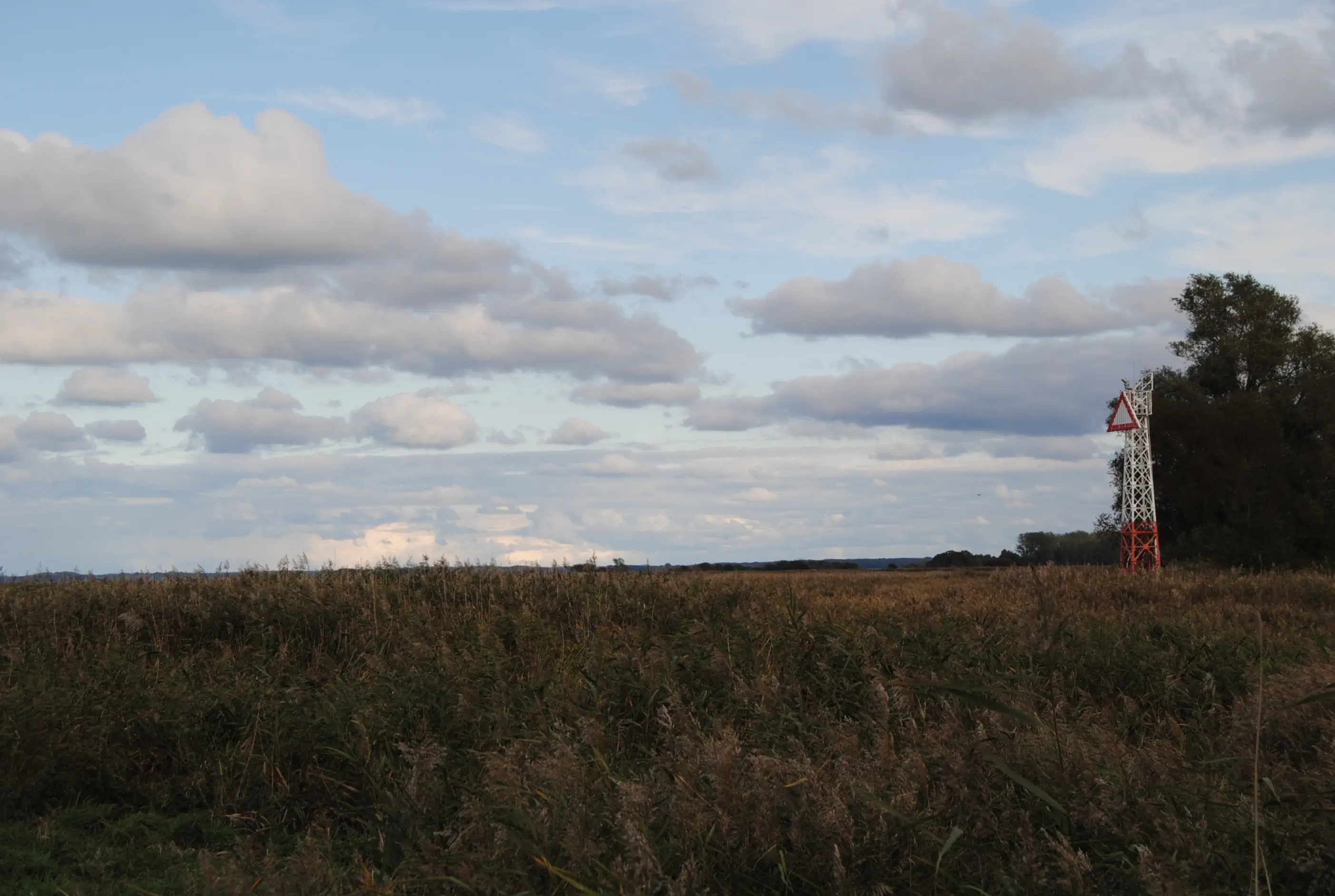
If you want to see the smallest chapel in Mecklenburg-Vorpommern and get a pilgrim's stamp there, you can walk into Bessin. A toilet and the development of a rest area are planned. Currently (11/19), a round bench in front of the chapel invites you to take a break. After that, you have to walk back a little. The direct route branches off to the right shortly before Bessin. Here the landscape opens up, with only meadows, reeds, water and sky. After a few hundred meters, the paved path turns into a path. Passing a lake mark, the path turns left and now always along the coast, mostly with a windbreak hedge between the path and the Strelasund. The natural landscape at the beginning still belongs to the Western Pomerania Lagoon Area National Park.
Depending on the water level, there is also the option of walking along the sandy beach and swimming in the sound about a kilometer before Altefähr. Always keeping to the water's edge, the blue-painted restaurant “Strandhaus” is the first building in Altefähr. Continue past the small bay and on the elevated wooden walkway, the Altefähr church tower can soon be seen on the left. Passing through the harbor, you will come to an Italian restaurant, the tourist information office and the harbor master's office, in front of which stands a large wooden sculpture of a ferryman. This guild gave the village its name. The tourist information office will soon be providing a pilgrim's stamp and, in the more distant future, a toilet. To the left of the building, a pedestrian path winds up to the Kirchberg.
St. Nikolai Church (Altefähr):
The old seafarers' church stands directly above the ferry dock and is a real gem. The oldest parts of the building date from the 15th century. Its interior is richly decorated with precious wall and ceiling paintings and some model ships. The church was painted at the end of the 17th century. A carved inscription refers to the year 1737, and the present barrel vault in the nave was probably added during a renovation. The gabled roof, which still exists in this form today, was also constructed in this year. The tower, which collapsed in 1803, was rebuilt and extensively renovated in 1912/13. The altar shows a mirror-image copy of the Last Supper by Peter Paul Rubens (1577-1640). There is a pilgrim's stamp in the church.
Directions:
Kirchstraße, which runs along the cobblestone road, meets Bahnhofstraße. Turn right, past the small supermarket “Dit und dat” and continue for about 200 meters. The parsonage is on the right side of the street. The retreat center is directly behind it.
Morning Prayer
You turn to those who seek you, take in all who take refuge with you. Be found where all is lost. Where all collapses, do not stay away. Come up in the words with which we make peace. Sytze de Vries, day after day. The Schalkwijk Translation Report. Utrecht 2008, p. 22
Midday Meditation
SEE: the expanse; sky and cloud formations; the white-tailed eagle hunting; water surfaces, sometimes agitated, sometimes as smooth as glass.HEAR: the cry of a seagull; the buzzing of insects; the lapping of the waves – silence.
SMELL: the scent of seaweed and the lake; potato roses at the wayside; a ripe apple
FEEL: the wind on my skin; the warmth of the sun; aching feet that need a break
TASTE: coffee from the thermos; bread and butter with cheese and tomato; trail mix as the crowning glory
Evening Prayer (Nordic song of the sea)
After the storm, we ride safely through the waves, great creator, let our praise resound to you. Praise him with heart and mouth, praise him at every hour! Christ, Kyrie! Come to us on the sea!
By Johannes Daniel Falk (partly on the church tower clock in Altefähr)

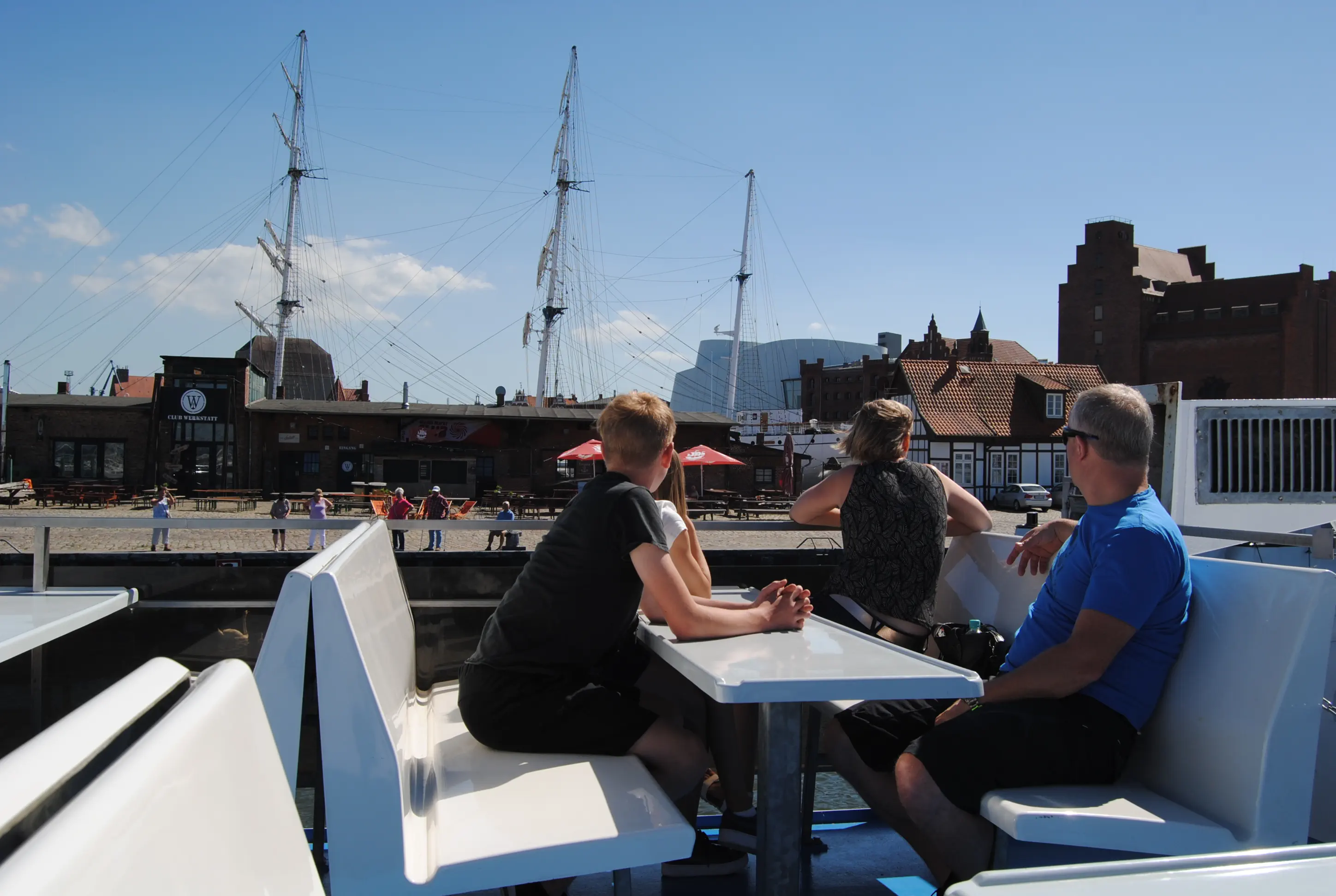
Depending on your preference, you can take a short hike across the Rügendamm to Stralsund (5.4 km from the Altefährer Nikolai Church to the Catholic Church of the Holy Trinity on the edge of the old town), take the bus (www.vvrbus.de Line 1, get off at Hafenstraße) or take the ferry to Stralsund from May to October (weisse-flotte.de/fahrplan/stralsund-altefaehr). A subsequent city tour in Stralsund is today's task.
Starting point: Altefähr, Rüstzeitenheim Rügen
Destination: Stralsund
Distance and time: as required, route 5 km, city tour 5 km
Address and contact details for accommodation
Stralsund: Catholic Church of the Holy Trinity: Pilgrim Accommodation, Frankenwall 7 entrance, 18439 Stralsund, tel. 0049 3831 292042, heiliger-bernhard.de/gemeinden-orte/heilige-dreifaltigkeit/stralsund, kitchen, shared rooms and showers available, price: donations requested.
Stralsund: Hostel Stralsund, Reiferbahn 11, 18439 Stralsund, Tel. 0049 3831 284740, www.hostel-stralsund.com, shared kitchen, no bunk beds in shared rooms, prices: from €35 for a single room, from €16 per person in a shared room, bed linen €4.
Stralsund: Pilgrims' room at Antje Schuldt, Heilgeiststraße 31, 18438 Stralsund, +491722936977.
Directions:
On the “Bahnhofstraße” in front of the Rüstzeitenheim turn right and walk out of the village. At the end there is a short stretch of avenue where the cars drive on cobblestones parallel to the footpath, then turn
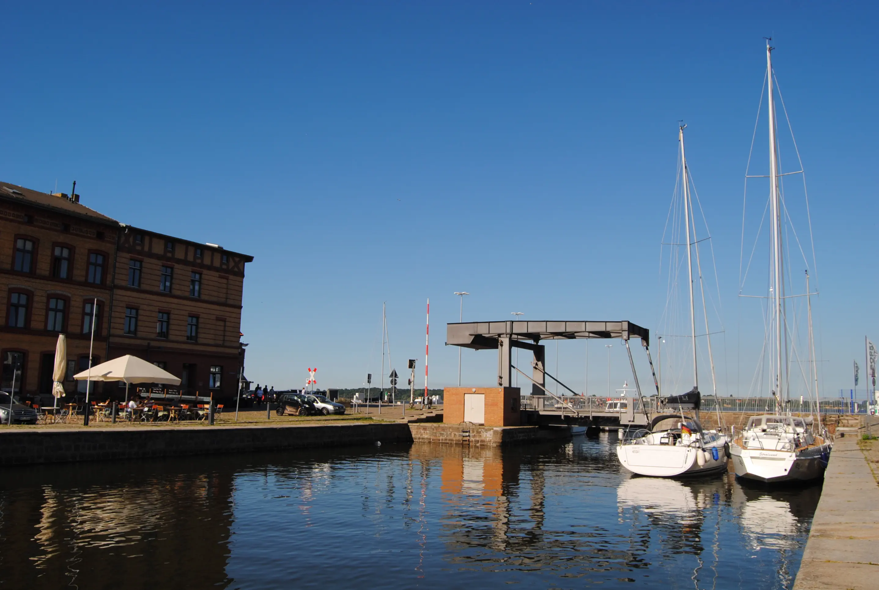
right onto a path to the Strelasund. Slightly downhill and with the new federal highway B96n on the left, it goes up to an iron gate. To the left of this, a cycle/pedestrian-only path begins, which leads under the B96n. Then it goes slightly uphill to the right over the Rügendamm to Dänholm, a small island on the way. The Ziegelgrabenbrücke behind it opens five times a day for about 20 minutes (9.20, 12.20, 15:20, 17:20 and 21:30). In summer, sailing boats and large ships maneuver through this pass one after the other. An interesting spectacle! Here you also have the opportunity to throw your “worry stone” or your “sin stone” into the sound and thus part with it.
Leaving the Rügendamm with the drawbridge behind you, turn right into Ziegelstraße at the first opportunity. It goes under the enormously high, new bridge, under which a three-storey house can be found here. Follow the left turn of “Ziegelstraße” and at the end turn right into “An der Hafenbahn”. The road passes the city harbor of Stralsund (on the left) and after a slight left turn is called “Am Langenkanal”. Passing the Ozeaneum parking garage, the first smokestack of the harbor, called Flipper, is on the left. Behind it, a small bridge spans the Querkanal and turns into “Langenstraße”. This is the center of the harbor district of the UNESCO World Heritage city of Stralsund, unfortunately surrounded by a lot of traffic. After the bridge, take the third street on the left, “Wasserstraße.” After a few meters, you will see the Heilgeist Church on the left-hand side, which is usually open during the day. More about this on the city tour.
Before the roundabout, turn right into Frankenwall, where you will reach the Holy Trinity Catholic Church on the right after about 150 meters. The pilgrim accommodation is located in the house on the right.
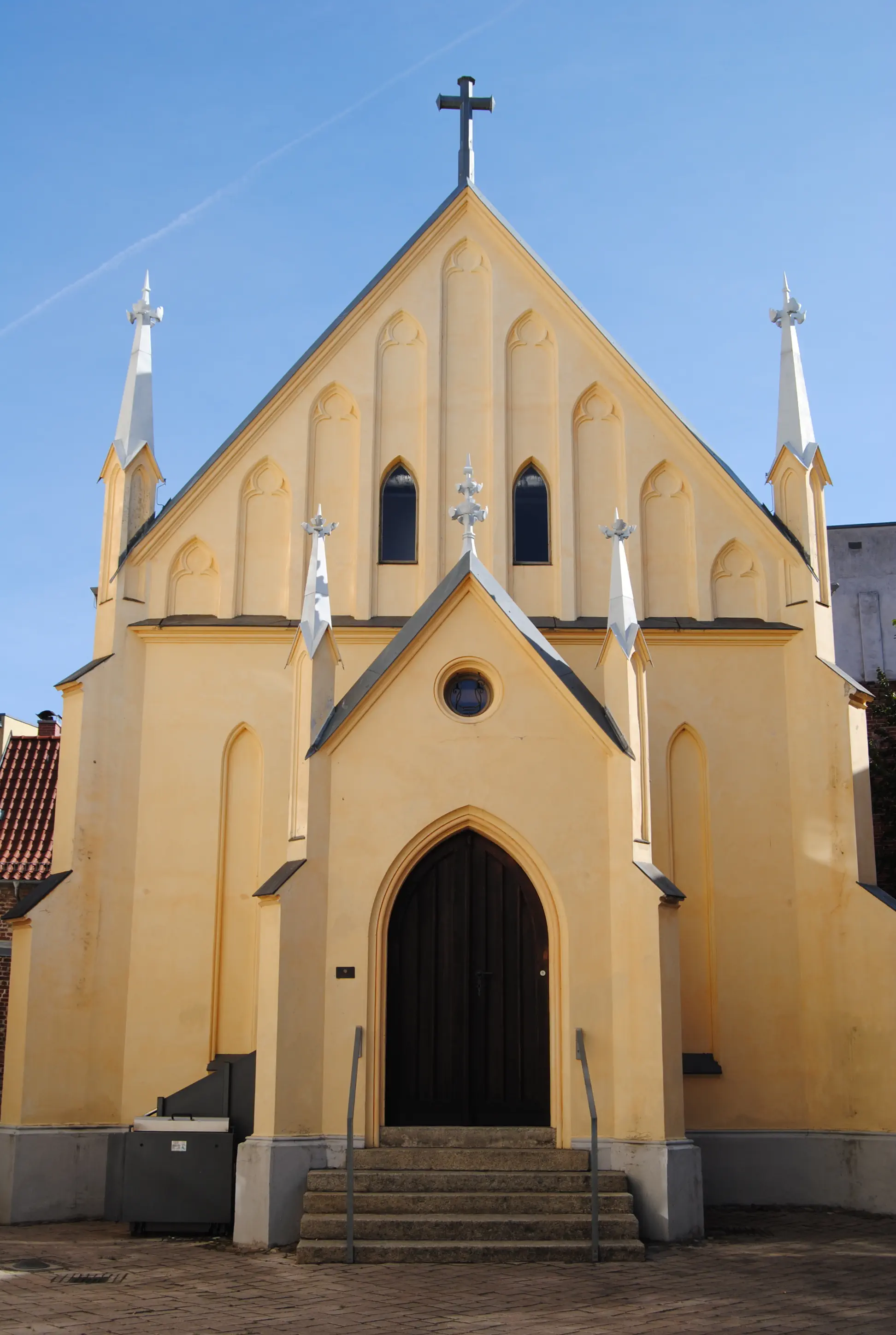
Catholic Church of the Holy Trinity (Stralsund):
The Reformation, led by the monk Christian Ketelhot, spread so strongly in Stralsund that the large churches of St. Nicholas, St. Mary and St. Jacob were now used by Protestants. After that, the Hanseatic city was under the Swedish crown for almost 200 years (1628-1823). Even under the Protestant Swedes, the small group of Stralsund Catholics remained without their own place of worship. But in the middle of the period of Swedish rule, the group founded a Catholic mission. A few years later, in 1784, the foundation stone was laid for a Catholic church in Frankenstraße. The Swedish king intended to give his mercenaries, many of whom came from Catholic countries, a place for their mass. And just one year later, the church was consecrated. It had 200 members, including many mercenaries, but also merchants and artists from other countries and regions. Soon the church had to be enlarged and during the reconstruction in 1905 it was given its present appearance. A planned tower construction failed due to a lack of funds. Today the entire Catholic community (Barth, Richtenberg, Stralsund and Zingst) has around 3000 members.
City tour:
First, it's just a few steps back to the Heilgeistkirche in the “Wasserstraße”.
Church of the Holy Spirit (Heilgeistkirche) (Stralsund):
The Heilgeistkirche (Church of the Holy Spirit), the neighboring building and the residential buildings behind them form the former municipal hospital. Originally, the hospital was a shelter for the poor, weak, needy, travelers and, of course, the sick. Two doors can still be seen today from the inner courtyard, leading to the galleries in the church. Here the sick could attend church services without coming into contact with the healthy people in the nave. The Stralsund Hospital was built in the immediate vicinity of the harbor between 1325 and 1329 and consisted of a poorhouse, small half-timbered huts and the church. Since the hospital was located outside the city walls, it was repeatedly destroyed throughout history. Although parts of the church date back to the Middle Ages, such as the Gothic west wall, its present form dates from the 19th century. It has no tower of its own; a ridge turret with an open “lantern” (the roof hood) was simply added on the side facing the waterway.
City tour:
The city tour then continues back over the Querkanal bridge, where the Flipper incense boat is moored on the right. But now we continue on the road along the Querkanal to the left. Automatically, the path leads to the left over a bascule bridge, which was built in 1932 for the railroad, which was then shipped daily to Rügen from the quay behind it. But just four years later, the Rügendamm was built. Trains have not crossed this registered technical monument since. In summer, it is raised if necessary to let sailors pass with their masts.
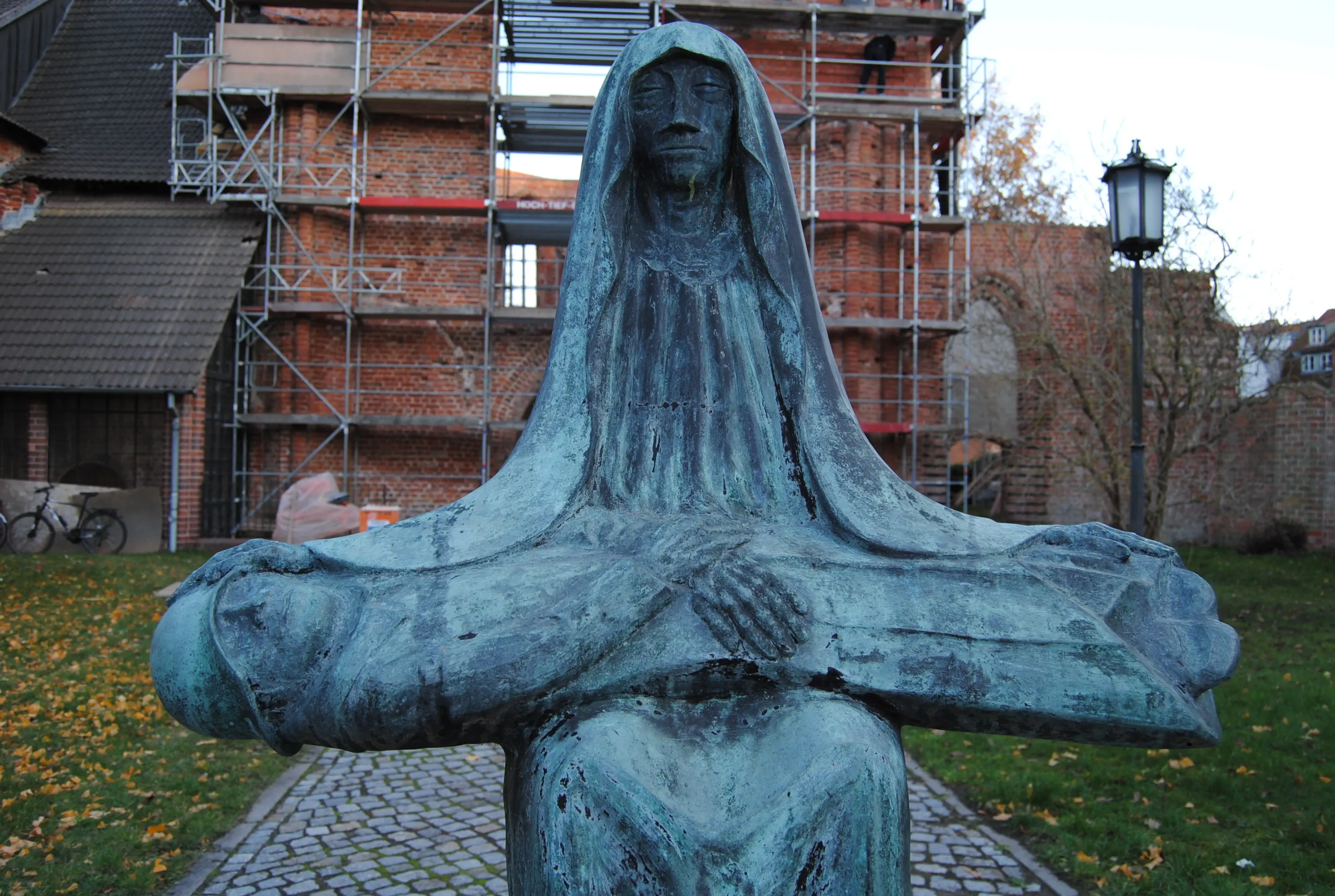
There are restaurants, cafés and fish shops in the shops and on the boats throughout the entire harbor area. The sound on the right side can be walked along past the pilot house (also on the right), built in Prussian brick, which is now the harbor master's office, and the museum ship Gorch Fock with its square rigging. On the left, former warehouses rise up into the sky; today they are used exclusively for gastronomic purposes. At the end of the harbor island, turn left. The twin towers of St. Nikolai Church can be seen on a hill. Another pedestrian bridge leads to the street “Am Fischmarkt”. Cross it and continue straight ahead into the uphill “Fährstraße”. On the right is the oldest pub in Stralsund, “Zur Fähre”. Further up, one of the “talkative women” holds out his bronze finger to all those who make it to the top. The Mägdebrunnen, by sculptor Günter Kaden, was created in 2003. Schillstraße branches off to the right of the fountain. Soon you will see the ruins of the Johannis-Kirchenchor, a former Franciscan abbey, on the right. The church was destroyed during the bombing of Stralsund in October 1944. The ruin is now preserved as a memorial. In front of it stands the bronze Pietà, cast according to a design by Ernst Barlach. The now famous sculptor Barlach submitted the design and a model to a competition held by the city in 1932, but was not chosen at the time. In view of the mother, who gazes haggardly and with a vacant look at her dead son, who is wearing a World War I soldier's uniform, it is clear: in the pro-war atmosphere of the 1930s, this design had no chance. The Güstrow sculptor Hans-Peter Jaeger finally cast it in 1987 according to Barlach's form. On the way back through the beautiful courtyard of the monastery, which was restored in 1960, where there is a memorial to the Jewish victims of the Second World War, you can take another small detour. But only if the public order office is open (Stralsund Public Order Office, Mon, Tue, Thu, Fri 8-12 and Tue 13-18, Thu 13-16). Otherwise, continue straight ahead into the small “Külpstraße”. It ends at the “Alten Markt”, where the town hall with its impressive gable and the Nikolai church form a harmonious unit.
Detour:
From the courtyard of the Johanniskloster turn right and walk along “Schillstraße” across the intersecting “Knieperstraße” to Schillstraße 57, the public order office. The courtyard of the authority contains the chapel of St. Annen and Brigitten. The original building probably dates from 1480 and was initially built only for the sisters of the Order of St. Anne. During the Stralsund “Church Breaking” in 1525, the Birgittines lost their entire Mariakron monastery complex due to wanton destruction and plundering and found shelter with the St. Annen sisters. It is therefore actually a chapel of the Order of the Redeemer, the name “Brigitta” is misleading. The chapel standing in the inner courtyard today dates from the early 16th century, and the original building also appears to have been destroyed. The new building was not consecrated, which is why civil weddings can be held in the chapel today. From here, back a little way, turn right into Knieperstraße and you will come directly to the Alter Markt square.
St. Nikolai Church (Stralsund):
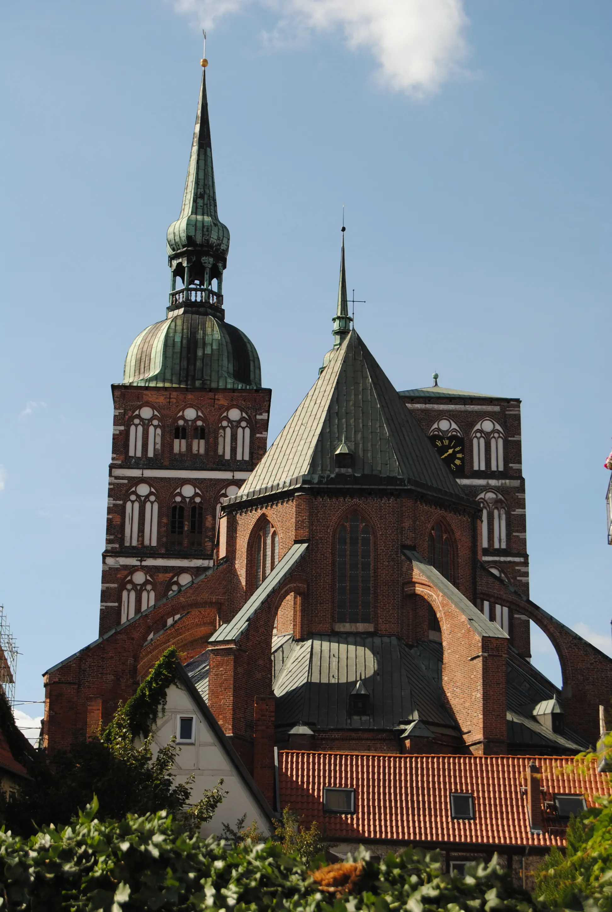
It is the oldest church in the city. Planning began and construction work started immediately after the city was granted its town charter in 1234. However, a fire or a collapse prompted the builders to demolish the already constructed choir. It took another 80 years (until 1350) to complete the church, which was built in pure brick Gothic style and according to the French cathedral model. In 1662, a fire destroyed the two towering Gothic spires. To this day, the south tower is adorned with a baroque dome, while the other only has a makeshift roof. It is well worth a visit, because despite the wave of destruction, the Stralsund “church breaking” in 1525, the Nikolai Church and monastery treasures from the entire Hanseatic era are inside. The entrance is located on the “Old Market”, to the left of the town hall and towers, in a new glass annex. A detailed flyer with a map of the statues, altars (in particular the Olav Altar in the choir), grave slabs and the astronomical clock is available at the ticket office. Opening hours: April–October Mon–Sat 10 am–6 pm, Sun 12 noon–4 pm, November–March Mon–Sat 10 am–4 pm, Sun 12 noon–3 pm. Admission: €3 per person.
City tour:
After visiting the Nikolai Church, walk past the gabled façade of the town hall on your left. The tourist information office is located straight ahead and provides a free map of the old town. The route leads left through the pedestrian zone, past the World Heritage exhibition at “Ossenreyerstraße 1”. The pedestrian zone then turns right into the “Apollonienmarkt”, then left into the last part of the “Mönchstraße”, which leads to the “Neuen Markt” opposite the Marienkirche.
St. Mary's Church (Stralsund):
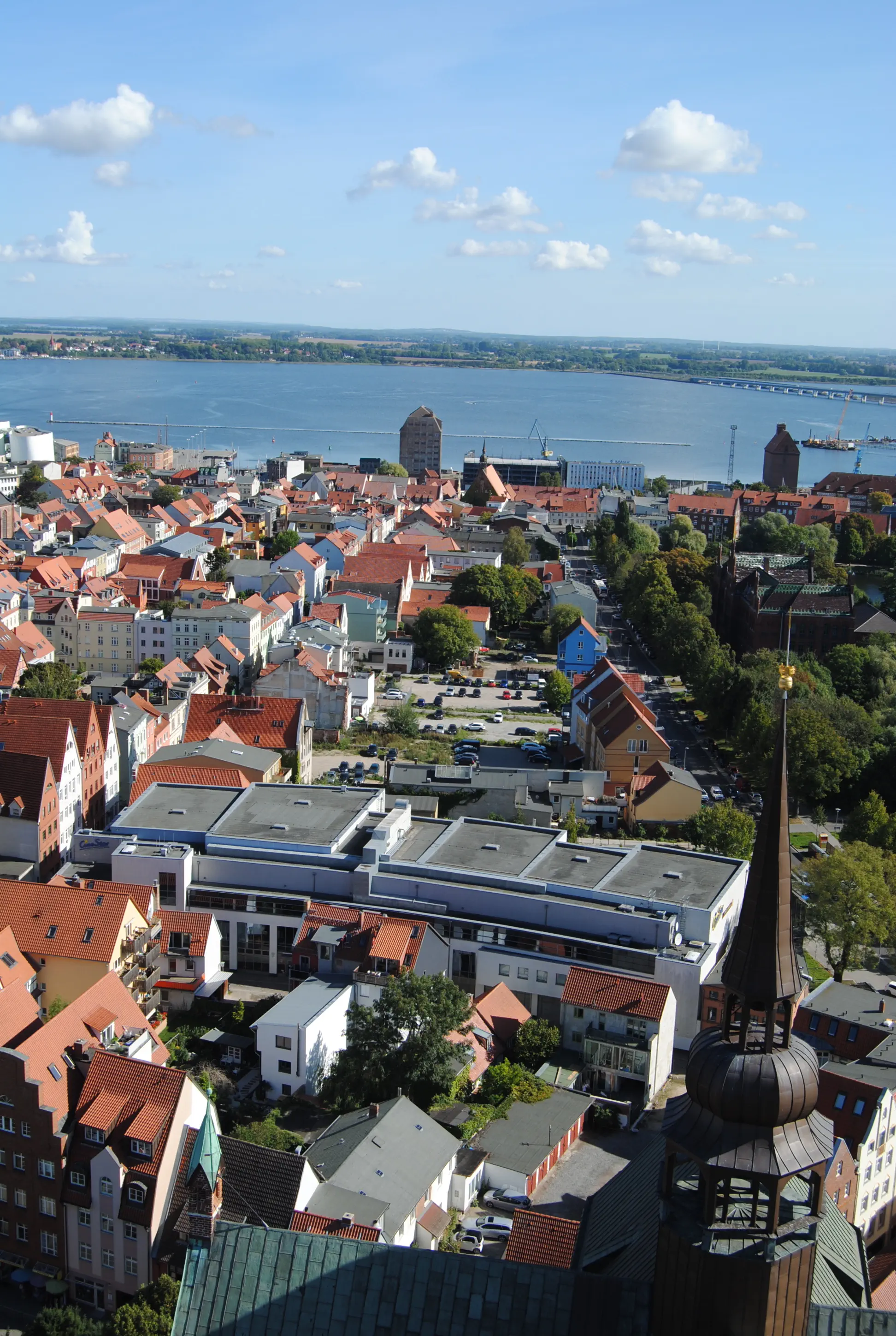
The three-aisled basilica with transept, western pseudo-transept, ambulatory and chapel ring and its 104-meter-high tower is the largest church in Stralsund. It is considered a masterpiece of the late Gothic period and was first mentioned in 1298. However, the collapse of the church tower in 1382, as well as storms and fires, repeatedly resulted in changes to the building. Originally, the Marienkirche in Lübeck served as a model. During the Hanseatic period (1293–1628), the Hanseatic League cities looked to Lübeck, the nucleus of the Hanseatic League, for guidance. To enjoy the view from a height of 90 meters over the city, the Strelasund and to Rügen, 366 steps must be climbed in the tower. Tower ascents April–October, 9–18 o'clock, except during church services. The entrance fee is 4 € p.P.
City tour:
After climbing the tower of St. Mary's, turn right twice to get back to the “Neuen Markt”. Here you will find several snack bars and restaurants. The church on your right is where “Frankenstraße” begins. To see the third large church in Stralsund, you only have to walk a few meters. To do so, turn into the third street on the left, “Jacobiturmstraße”, where the Jakobi is within sight. The former pilgrimage church has been used for secular purposes since the GDR. It is organized by the district deaconry together with the Hanseatic city of Stralsund. Exhibitions and cultural events as well as occasional church services and concerts take place here. Walk past the church, then turn right into Papenstraße and continue until you reach Frankenstraße. Go back a little way here, then turn left into Priegnitz. The short lane ends at Frankenwall, where you turn left. After a few meters, you will reach the courtyard of the Holy Trinity Catholic Church again.
Stone Meditation
The Bible says that God will sink our sins into the depths of the sea (Micah 7). They are then gone and no longer burden our lives and relationships.
The stone in your pocket: It symbolizes a burden of life. What am I carrying around with me? What do I want to let go of? What do I want to get rid of?
Maybe the pain of a failed relationship. Perhaps I have been wronged and it is hard for me to get over. Or I myself have wronged someone. It drains my life energy.
In the Bible, sin refers to a relationship disorder. There is something like a wall between me and a person. And there is something between me and God.
This hinders my vitality, my development, my life. If I want to change something about this, the impulse must come from me. God took the first step a long time ago.
In the Bible, sin also means missing the mark. Missing the point in life. For example, when I constantly fall short of my potential. When I don't pursue my goals out of cowardice or live according to the premises of others that I don't actually share. God has created unique, one-of-a-kind people. Each with their own merits. I don't have to live as a copy or constantly compare myself. I can become the person God already sees me as. Become what you are! Life takes place between “becoming myself” and the search for healthy relationships. I can always seek this balance and organize relationships or start anew. And then move on with light luggage.
Therefore, I can let go of my burden – my stone – and throw it into the depths of the sea.
Prayer
God, I let go of the burden of my life, I throw it into the sea. God, I let go of my negative feelings and give them to you. God, I let go of my fears and doubts, my inferiority complexes and give them to you.
You look at me with love and trust. You have placed great potential in me and trust me to do good. I now trust myself too. I continue on my path through life with a lighter heart and an upright spine. Be my companion, my mentor, my motivator. Amen.
Tower Meditation
Meditation – Change of Perspective: From the tower of St. Mary's Church, the view sweeps over land and water. First to the north, back to the island of Rügen. That's where I come from. In my mind, I let the experiences of the last few days pass by. What moved me? What have I been carrying around with me in the way of anger, suffering, disappointed hopes? What inspired me in the way of good encounters and reassuring simplicity?
In front of me lies the Strelasund, separating the island from the mainland, and the Strelasund Bridge, connecting them. What do I want to let go of? What thoughts and feelings do I want to let go? Perhaps I have symbolically sunk a stone in the sound for this.
116 day stages of Birgitta's pilgrimage
What connections do I want to keep? What from my past nourishes me? Where do I want to build bridges?
My gaze wanders further south. The mainland lies before me. My further path. Future land? Land of hope?
Do I want to engage with the future with complete trust? What sustains me? Who will help me?
A visit to the church nave can provide strength for the onward journey. I can light a candle for someone with whom I want to clarify my relationship or who has been a special companion on my journey through life.
I can say a prayer and ask for God's guidance and blessing.

Hike from Stralsund to Krummenhagen: Shortly after Stralsund railroad station, the scent of country air begins and continues along fields and through a forest.
Starting point: Stralsund
Destination: Voigdehagen or Krummenhagen
Length and time: Voigdehagen (7 km), 2 hours or Krummenhagen (15 km), 5 hours
Address and contact details for accommodation
Voigdehagen: Pfarrhaus, Voigdehagen 17, 18439 Stralsund, Tel. 03831 290446, heilgeist-stralsund.de, sleeping in beds with sleeping bag, kitchen, shower, price: 13 € p.p.
Krummenhagen: Eulenhof (or Lehmziegelei opposite), Dorfstraße 32, 18442 Steinhagen OT Krummenhagen, oebik.de, reservations as early as possible on Tel. 0172 6723616 (Mr. Wilhelm), shared room, shower, kitchen available, price: 15 € p.p.
Directions:
The pilgrimage route within Stralsund is insufficiently marked. However, an improvement is in sight (as of 11/2019). One of the few symbols can be found on the wall of the Catholic parish office - at the back of the pilgrims' accommodation - at Frankenstraße 39. The pilgrims' route begins with a walk through Frankenstraße in a westerly direction to Neuer Markt. Anyone who did not climb the tower of St. Mary's Church during the city tour can do so now. Past St. Mary's Church, continue straight ahead into “Bleistraße”. The small alley meets Marienstraße, turn right there, then left until you reach the large crossroads. Continue straight on along Triebseer Damm past the Younior Hotel and then the main railway station. Immediately after crossing the tracks, the pilgrims' path leads left into “Rostocker Straße”, which bends to the right. In an arc to the left, it leads into “Alte Richtenberger Straße”. Behind the VW car dealership, the street “Knöchelsöhren” branches off to the left. The road clearly leads out of the town. Behind the premises of the Nordkurier company, it continues straight ahead as an unpaved path past allotment gardens. The path ends at the “Am hohen Graben” arterial road, where it continues left under the elevated road to a traffic circle. The path ends on the separate footpath and cycle path on the left-hand side about one kilometer before Voigdehagen. Follow the little-used road into Voigdehagen, then turn left down to the church.
Church (Voigdehagen):
Das dörfliche Voigdehagen ist ein Stadtteil Stralsunds und die Kirche auf dem Hügel ist die Mutterkirche der großen Stralsunder Stadtkirchen. Von der Vorgängerkirche gibt es keine Zeugnisse mehr. Das heutige Gebäude stammt aus dem 15. Jahrhundert und wurde aus Backstein auf einem Feldsteinsockel errichtet. Nach starken Zerstörungen im 30-jährigen Krieg und dann noch einmal in den Kriegen des 18. Jahrhunderts wurde der Turm nicht wie
der errichtet. Neben dem Gebäude gibt es einen separaten Glockenstuhl. Der Eingang liegt heute im Süden, direkt vom Friedhof kommend.
Directions:
From the district of Voigdehagen, which has 74 inhabitants, the route leads along the village road out of the Hanseatic town and across the main road (B96), through Wendorf and further along the road into Zarrendorf. Here it is first called “Wiesenweg”, then “Kirchstraße”. From “Kirchstraße”, “Waldstraße” branches off to the right. Almost at the end of “Waldstraße”, the pilgrims' path leads to the left, now finally into the forest. It ends in Krummenhagen at the “Dorfstraße”. Turn left here until you reach the clay brickworks. A few meters further back is the Eulenhof, a white half-timbered house without a visible name. Overnight accommodation is available in the rear part of the Lehmziegelei or in the Eulenhof.
Thoughts in the morning
I am glad and rejoice in your lovingkindness, O God, because you look upon my affliction and know the distress of my soul, and do not deliver me into the hands of the enemy; you set my feet on a broad place. (Psalm 31:8+9)
Evening Prayer
Once again my path goes back, God. A good part of the way lies behind me. Inwardly and outwardly. I have changed. My thoughts have changed. I see some things from a distance. My problems at home. My normal life. From this distance, I can judge some things differently.
I get closer to my goal with every milestone. But perhaps my goals are also more like milestones? Where do I want to go? Where will I arrive? Inwardly and outwardly? Is there a goal in life? Or is death also just a stage? I have more questions than answers. But you set my feet on a wide open space. I don't have to have all the answers, but I can still go on with confidence. Some answers I can find for myself. Others come to me. Thank you for the space, God. Amen.

Hike from Krummenhagen to Richtenberg: The hinterland of Stralsund is flat and sparsely populated. In spite of this sparseness, it is good for a few surprises, such as the wonderfully quiet paths and the magnificent interior of the Richtenberg church.
Starting point: Krummenhagen
Destination: Richtenberg
Length and time: 14 km, 4 hours
Address and contact details for accommodation
The originally planned overnight stay in the Richtenberg vicarage is no longer possible.
However, two beds are available for pilgrims in the Franzburg vicarage, about 4 km further along the pilgrimage route to Tribsees, by prior arrangement:
Pfarrhaus Franzburg, Priesterbrink 7, 18461 Franzburg, Tel. 0163 4014323 (Mrs. Kunkel), Tel. 038322 551091(Pfarramt), franzburg-buero@pek.de
Beds for up to two people are available, otherwise bring your own sleeping mat and sleeping bag, bathroom with shower available, use of the community kitchen, price: €10 p.p.
Directions:
The pilgrimage route to Richtenberg is well marked with signs and stickers, some of which are faded, and yellow arrows. Before the Eulenhof farm, the path turns left along the village road from Krummenhagen in a westerly direction to the main road (B194). Here it leads to the right for around 100 meters along the main road, then turns left at the first opportunity into “Straße der Jugend”. At the end of the road, turn right, then left down Dorfstraße to the village church of Steinhagen.
Village church (Steinhagen):
Located near the Neuenkamp monastery (Franzburg), the brick hall church was first mentioned in the 13th century. The whitewashed church has medieval frescoes and baroque furnishings. Particularly noteworthy is a “murder cheek” from the 15th century. The steles were erected after the verdict at the place where the murder had taken place. It is also known as the “Süh nestein”. The church is open April - October 9 am - 6 pm.
Directions:
Behind the village church, the pilgrims' path turns right into “Bäckerweg”. Initially asphalted, the road leads into a paved path. Behind two farms, the path continues unpaved into the forest. Now continue straight ahead until you leave the forest and enter Jakobsdorf. The rough direction in the pretty village is straight ahead, from the “Steinhäger Weg” a short distance onto the “Hauptstraße”, then on the “Dorfstraße” out of Jakobsdorf. Cars rarely drive on the bumpy paved road. It ends at the “Richtenberger Chaussee” (L192). Shortly afterwards, the country road leads to the right into Richtenberg. With the Shell petrol station on the left, “Bahnhofstraße” runs parallel to the main road and is the quieter option as a pilgrimage route. At the end of this road, turn right and continue along Hauptstraße for around one kilometer until Küsterstraße branches off to the left. Behind St. Nikolai Church, set back a little, is the vicarage, which overlooks Lake Richtenberg.
St. Nikolai Church (Richtenberg):
Situated on a hill overlooking Franzburg Lake, St. Nikolai Church and its choir were built from brick and fieldstone in the 13th century. Like the entire village, the church belonged to the Neuenkamp Cistercian monastery in 1231. A nave and the church tower were added at the beginning of the 15th century. The magnificent interior is largely baroque. The interior was last painted in 2014 during extensive renovation work. One of the two chandeliers in the central nave was donated in 1747 because the donor had been spared from the cattle plague. The key to the church can be obtained from the vicarage diagonally behind the church portal or from Dr. Tauchert (Tel. 038322 50567).
Thoughts in the morning
A person's life becomes brighter when they begin to understand your word. Those who have gone through life without thinking will now become wise. My desire for your commandments is like the thirst of a person who is thirsting for water in the heat. Lord, turn to me and be gracious to me, just as you are to all who love you. Guide my steps through your word and do not allow evil to gain power over me! (Psalm 119:130-134)
Midday Meditation
At the height of the day, I pause. I gather my thoughts and come to rest. I use the rest to strengthen myself. My body and my mind. I close my eyes and listen: what sounds are coming to me? I take a deep breath: What do I smell? I notice my body: What do I feel? - I am with myself. And I am not alone. I feel your peace, which is higher than my reason.
Evening Reflection
A day lies behind me. A path through uneven terrain. - Past crowded streets: Where are the people going? What is their job? - Past houses: Who might live here? Are the residents happy in their lives and with their families? - Past fields and meadows: This is where my food comes from. Is the cultivation compatible for humans, animals and the environment? - Past churches: What do they want to tell me? - They are references to God. God, who are you and who are you for me? Who am I in the hustle and bustle of this world?
Address and contact details for accommodation
Tribsees: Pilgrim accommodation in the Löwenau family's vacation apartment, Sülzer Chaussee 17, 18465 Tribsees, Tel. 038320 47176, price: 15 € p.p.
Tribsees: Pilgerhus, Karl-Marx-Str.12, 18465 Tribsees, Tel. 038320 437, pilgerhus.de, beds or with sleeping mat and sleeping bag, price: from 11 € p.p.
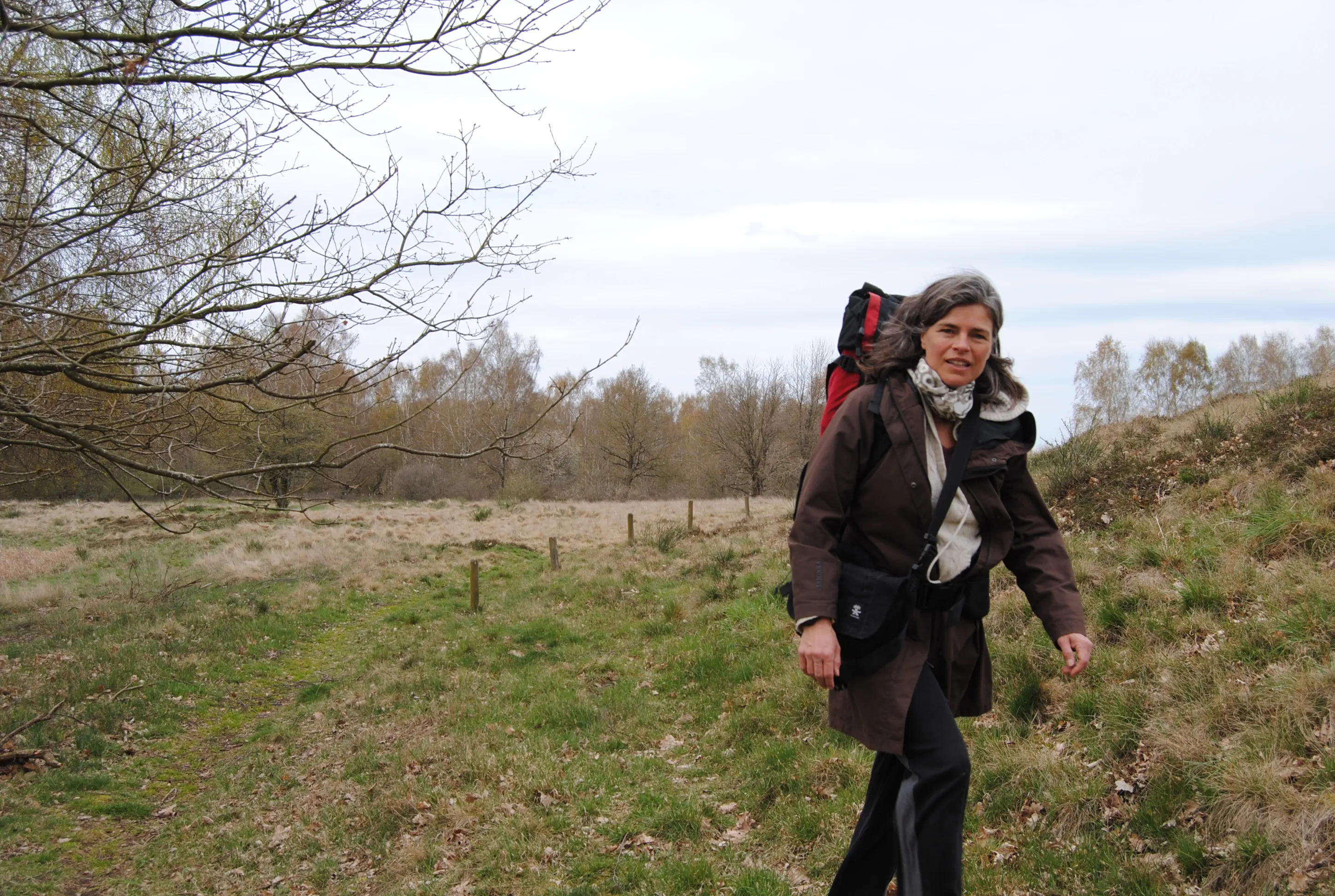
Directions:
From the vicarage, walk a few meters straight ahead on “Küsterstraße” until you reach a staircase leading down to the lake. At the lakeshore, the path leads left along the lakeside path. The lake remains on the right until the path leaves the shore via the parking lot of a sports field. The viewing platform remains on the right and the path continues straight ahead along the pasture fence until it reaches a cycle path. Here the path turns right and follows the cycle path, again along the lakeshore. Continue until you reach a school building on the left, with a brick chimney from the old boiler house right next to the path. Shortly before this, a somewhat inconspicuous footpath turns off to the right and leads directly down to the lake. Follow the shore until you reach the outdoor pool. Here, turn right up Gartenstraße and continue straight ahead to the gallery in the old district administration office. Walking around this first part of the building, you come to the monastery garden with its café (Café Wieckhaus, Geskestraße 2, 18461 Franzburg, tel. 038322 551015, cafe-brautkleid-wieckhaus-franzburg.com). Franzburg church is located directly opposite the monastery garden.
Church (Franzburg):
The church and town have a colorful history. The Franzburg church used to be a side wing of the Cistercian Neuenkamp Abbey, which was built here in the 13th century. After the Reformation, the abbey was secularized and largely destroyed. Duke Bogislaw XIII built a castle modeled on Stettin in place of the former monastery church. A few parts of the former monastery were integrated and so the wing was preserved as a castle church. At the end of the 16th century, Franzburg was founded near the residence as a craftsmen's settlement. The permanent residence was abandoned in 1605. During the Thirty Years' War, the castle was destroyed by imperial troops and eventually demolished. The Renaissance castle church was the only one to survive and from then on was used as the town church. During the Great Northern War (1712) and during the Napoleonic period, the town and church were severely devastated. At the end of the 19th century, the church was completely renovated and redesigned in the neo-Gothic style, but was built over during the GDR era. In the 1990s, the condition deteriorated noticeably. As a monument of national importance, the renovation of the church was financed between 2010 and 2012 with the second economic stimulus package. The key to the church can be obtained from Café Wieckhaus.
Directions:
Coming out of the monastery garden, turn left along the street “Kirchplatz”. It leads onto a farm track, which the pilgrims' path follows straight ahead. After around 200 meters at the fork in the road on the right past some gardens, the path quickly leads out of Franzburg into a small wood. Here, a small spring bubbles up through an ornate structure: the “Mönchsquelle”.
Turn right between the trees into open terrain. A boulder, painted yellow with a black arrow on it, points the way. It goes up to the left along a cement slab path. Shortly after the former sand pits on the left, which are now overgrown, leave the concrete slab path to the left and follow a path through the meadow. This winds its way past another yellow boulder and a display board about the local animals across the hilly, rough meadow landscape of the Hellberge.
Continue straight ahead through a metal gate that separates a sheep meadow. Follow this nature trail in the Hellberge nature reserve, which meets the cycle/hiking trail to Tribsees after around one kilometer. On the sheep meadow, the knee-high piles provide orientation. In a hollow at a display board about wetlands, the pilgrims' path branches off to the right. The path then winds uphill and through the second metal gate it ends on an asphalt path, where it continues to the right. The Birgittenweg continues straight ahead on this path for four kilometers. From the covered rest area “Neumühler Hütte”, the cycle and pedestrian path is accompanied on the right by a paved road for cars, but there are hardly any vehicles on it. From Pöglitz, the route continues to Rekentin, where the Birgittenweg meets the Via Baltica. The Via Baltica begins in the Polish town of Swinemünde, leads via Usedom, Greifswald, Tribsees, but then via Rostock, Wismar, Lübeck, the south of Hamburg and Bremen to Osnabrück. There, the Via Baltica joins a Westphalian pilgrimage route. For a few kilometers, until Langsdorf, a town on the next day's stage (day 13), the Birgittenweg and Via Baltica remain united. After Rekentin, the road forks, turning left to Siemersdorf, while the pilgrims' path continues to the right on a paved path. The tower of Tribsee church can now be seen in the distance. For the last 200 meters or so, the pilgrims' path leads along the access road into Tribsees; depending on the weather, you can walk on the meadow next to it. After the town sign, continue straight ahead along “Goethestraße” until you reach the town gate on the right. Behind it are the church and the old town of Tribsees, which is well worth seeing.
St. Thomas Church (Tribsees):
The impressive size of the church reflects the enormous importance of the town of Triebsee in the early Middle Ages and later. Originating from a Slavic castle complex, the border town in the Trebel valley was of strategic importance. Crossing the river Trebel means entering new territory, now Mecklenburg land. The church's predecessor dates back to the early 13th century. The late Romanesque tower is all that remains of it. Most of the current building dates back to the 15th century. Destruction due to fires and wars repeatedly necessitated renovations and alterations. In the 19th century, for example, the church was given a neo-Gothic makeover. The interior is richly decorated. The valuable mill altar from the 15th century is a cultural and historical treasure. It takes its name from the mill scene in which the four evangelists, flanked by the twelve apostles, pour quotations from the Gospels into the funnel of a grain mill from sacks of grain. Out of the funnel comes “the Word”, which takes on a fleshly form as the boy Jesus. The kneeling church fathers Gregory and Jerome, assisted by Ambrose and Augustine, catch the child in a chalice.
Morning Verse
God, you are from eternity to eternity. You let people die and say: Come again, children of men! For a thousand years before you are like the day that passed yesterday and like a night watch. May the Lord our God be kind to us and further the work of our hands with us. (after Psalm 90)
Midday Meditation
Great churches - witnesses to an important time. Everything is transient. What have these buildings seen in terms of war and destruction, reconstruction and new construction, weddings and funerals, joyful church services and memorial services? And they are still standing because people consider them important. As a cultural asset, as a placeholder for the sacred. As a space for silence. As an impetus for questions:
What am I working for? What do I live for? What am I fighting for? What will last? For longer than my life? Where do I turn when my life is threatened, my health, my strength? May the Lord our God be kind to us and further the work of our hands.
Evening Prayer
Let our evening prayer ascend to you, Lord, and let your mercy descend upon us. Thine is the day and thine is the night. When the light of day fades, let the light of your truth shine upon us. Guide us through the darkness of the night and complete your work in us for eternity. Amen.
- Transmitted by unknown
